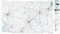
~ Salisbury NC topo map, 1:100000 scale, 30 X 60 Minute, Historical, 1985, updated 1986
Salisbury, North Carolina, USGS topographic map dated 1985.
Includes geographic coordinates (latitude and longitude). This topographic map is suitable for hiking, camping, and exploring, or framing it as a wall map.
Printed on-demand using high resolution imagery, on heavy weight and acid free paper, or alternatively on a variety of synthetic materials.
Topos available on paper, Waterproof, Poly, or Tyvek. Usually shipping rolled, unless combined with other folded maps in one order.
- Product Number: USGS-5374864
- Free digital map download (high-resolution, GeoPDF): Salisbury, North Carolina (file size: 21 MB)
- Map Size: please refer to the dimensions of the GeoPDF map above
- Weight (paper map): ca. 55 grams
- Map Type: POD USGS Topographic Map
- Map Series: HTMC
- Map Verison: Historical
- Cell ID: 68292
- Scan ID: 163118
- Imprint Year: 1986
- Aerial Photo Year: 1983
- Edit Year: 1985
- Datum: NAD27
- Map Projection: Universal Transverse Mercator
- Planimetric: Yes
- Map published by United States Geological Survey
- Map Language: English
- Scanner Resolution: 600 dpi
- Map Cell Name: Salisbury
- Grid size: 30 X 60 Minute
- Date on map: 1985
- Map Scale: 1:100000
- Geographical region: North Carolina, United States
Neighboring Maps:
All neighboring USGS topo maps are available for sale online at a variety of scales.
Spatial coverage:
Topo map Salisbury, North Carolina, covers the geographical area associated the following places:
- Mountain View Estates - Forest Hills - Erlanger - South Cecil - Steel (historical) - Meadowbrook - Pinson - Enochville - Nestleway Acres - Charles - Center - North Pugh - Foxcroft Apartments - Overbrook Acres - Currytown - Webbs - Brookgreen - Mocksville - Greencrest - Northmont - Mirror Park - Glenwood - China Grove - Trading Ford - Martins Store - Landis - Bethany (historical) - Jubilee - Cedarcrest - Eaman Park - Ridgewood - Elmwood - Ourdell - Raintree Estates - Jakesville - Williamsburg - Ravenwood - Johnsontown - Denton - Sandy Ridge Terrace - Morlan Park - Southmont - Dal-Wan Heights - Eureka Mills - East Spencer - Jimes (historical) - Lakeside - Eastover Acres - Corbin Hills - Five Forks - Houston (historical) - Eastfield Estates - McCall Heights - Montclair - Tyro - Mitchell Aire - Lincoln Heights - Rendleman (historical) - Hillcrest - Washington Park - Monbo - Watson Village - Watership Downs - East Brook - Cowans Ferry - Westport - North Barringer (historical) - Lakeview - Westwood - Clemmons Station - Healing Springs - Terrell - Friedburg - Liberty - Kingswood - Camelot Acres - Mill Hill (historical) - Cowin (historical) - Twin Oaks - Sedgefield Acres - Orchard Hills - Sheffield - Watts (historical) - Dickerson Estates - Westwood - Royal Park - Eastside - Needmore - Linwood - Granite Quarry - Grady Heights - Wendover Hills - Westcliff - Matthew (historical) - Churchland - Ian Joy Acres - Oakland Heights - Ellis Crossroads - Mill Bridge - Sapona
- Map Area ID: AREA3635.5-81-80
- Northwest corner Lat/Long code: USGSNW36-81
- Northeast corner Lat/Long code: USGSNE36-80
- Southwest corner Lat/Long code: USGSSW35.5-81
- Southeast corner Lat/Long code: USGSSE35.5-80
- Northern map edge Latitude: 36
- Southern map edge Latitude: 35.5
- Western map edge Longitude: -81
- Eastern map edge Longitude: -80

