
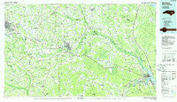
~ Kinston NC topo map, 1:100000 scale, 30 X 60 Minute, Historical, 1985, updated 1985
Kinston, North Carolina, USGS topographic map dated 1985.
Includes geographic coordinates (latitude and longitude). This topographic map is suitable for hiking, camping, and exploring, or framing it as a wall map.
Printed on-demand using high resolution imagery, on heavy weight and acid free paper, or alternatively on a variety of synthetic materials.
Topos available on paper, Waterproof, Poly, or Tyvek. Usually shipping rolled, unless combined with other folded maps in one order.
- Product Number: USGS-5374826
- Free digital map download (high-resolution, GeoPDF): Kinston, North Carolina (file size: 25 MB)
- Map Size: please refer to the dimensions of the GeoPDF map above
- Weight (paper map): ca. 55 grams
- Map Type: POD USGS Topographic Map
- Map Series: HTMC
- Map Verison: Historical
- Cell ID: 67770
- Scan ID: 162261
- Imprint Year: 1985
- Woodland Tint: Yes
- Aerial Photo Year: 1983
- Edit Year: 1985
- Datum: NAD27
- Map Projection: Universal Transverse Mercator
- Planimetric: Yes
- Map published by United States Geological Survey
- Map Language: English
- Scanner Resolution: 600 dpi
- Map Cell Name: Kinston
- Grid size: 30 X 60 Minute
- Date on map: 1985
- Map Scale: 1:100000
- Geographical region: North Carolina, United States
Neighboring Maps:
All neighboring USGS topo maps are available for sale online at a variety of scales.
Spatial coverage:
Topo map Kinston, North Carolina, covers the geographical area associated the following places:
- Brentwood - Mount Vernon Park - Dawson - Donaldson Mobile Home Park - Falling Creek - Closs - Hargetts Crossroads - Georgetown - Rivermont - Woodington - Centennial Arms - Pricetown - Howard Place Mobile Home Park - Husseys Crossroads - Wilmar - Brooks - Graingers - Pollocksville - Clayroot - Blizzards Crossroads - Johnsons Mills (historical) - Liddell - Langston - Spring Garden - Forest - Snug Harbor - Irvings Crossroads - Anderwood Estates - Castle Oaks - Herrings Crossroads - Ormondsville - Maplecypress - Elm Grove - Saulberry Subdivision Mobile Home Park - Askin - Kinstonian Hights - Beech Grove Mobile Home Park - Kennedy Estates - Oak Lawn - Moss Hill - Rhems - Northview - Stokestown - Westbrook Crossroads - Bucklesberry - Hullwood - Patsy Bran Mobile Home Park - Vinson Manor - Mary Beth Park - Tarheel Courts - Bernwood Mobile Home Park - Pleasant Grove - Oakdale - Belair Estates - Stoney Manor Mobile Home Park - Old Town Harbor - Red Wood Terrace Mobile Home Park - Venters - Strawberry Banks - Cresent Heights Mobile Home Park - Hickory Hills - Bellair - Cypress Shores - Woods View - Old Farm - Tanglewood - Pine Haven - Foxtail Mobile Home Park - Jackson Heights Mobile Home Park - Gradys - Darewood Estates - Mobile Home Park - Sheridan Forest - Lawsons Mill - Edgefield Forest - Redallia - Tiffany Gardens - Woodshire Mobile Estates - Woodrow - Sassers Mill - Best - Pot Neck - Circle L Mobile Home Park - Shine - Gradys Crossroads - Hugo - Southwood - Lenoir Pines - Haywood Farms - Browntown Crossroads - Pleasant Hill - Hookerton - Grayfield Mobile Home Park - Country Club Park - Kinston - Green Meadows - Tick Bite - Lawarence Hights - Hanrahan - Bowling Heights - Rountree
- Map Area ID: AREA35.535-78-77
- Northwest corner Lat/Long code: USGSNW35.5-78
- Northeast corner Lat/Long code: USGSNE35.5-77
- Southwest corner Lat/Long code: USGSSW35-78
- Southeast corner Lat/Long code: USGSSE35-77
- Northern map edge Latitude: 35.5
- Southern map edge Latitude: 35
- Western map edge Longitude: -78
- Eastern map edge Longitude: -77


