
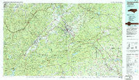
~ Hendersonville NC topo map, 1:100000 scale, 30 X 60 Minute, Historical, 1986, updated 1986
Hendersonville, North Carolina, USGS topographic map dated 1986.
Includes geographic coordinates (latitude and longitude). This topographic map is suitable for hiking, camping, and exploring, or framing it as a wall map.
Printed on-demand using high resolution imagery, on heavy weight and acid free paper, or alternatively on a variety of synthetic materials.
Topos available on paper, Waterproof, Poly, or Tyvek. Usually shipping rolled, unless combined with other folded maps in one order.
- Product Number: USGS-5374810
- Free digital map download (high-resolution, GeoPDF): Hendersonville, North Carolina (file size: 31 MB)
- Map Size: please refer to the dimensions of the GeoPDF map above
- Weight (paper map): ca. 55 grams
- Map Type: POD USGS Topographic Map
- Map Series: HTMC
- Map Verison: Historical
- Cell ID: 67662
- Scan ID: 162154
- Imprint Year: 1986
- Woodland Tint: Yes
- Aerial Photo Year: 1985
- Edit Year: 1986
- Datum: NAD27
- Map Projection: Universal Transverse Mercator
- Map published by United States Geological Survey
- Map Language: English
- Scanner Resolution: 600 dpi
- Map Cell Name: Hendersonville
- Grid size: 30 X 60 Minute
- Date on map: 1986
- Map Scale: 1:100000
- Geographical region: North Carolina, United States
Neighboring Maps:
All neighboring USGS topo maps are available for sale online at a variety of scales.
Spatial coverage:
Topo map Hendersonville, North Carolina, covers the geographical area associated the following places:
- Brown Arrow - Busbee - Twin Brooks - East Flat Rock - Tree Haven - Quebec - Hickory Hill - Mountain View - Balfour - Mount Valley - Little Africa - Butt Mountain - Uree - Silver Bluff - Woodrow - Cane Brake - Highland Park - Lake Lure - Mill Corner - Kenwood Knolls - Goodluck - Union Hill - Taho (historical) - Marietta - Mills River - Terry Creek - Sunny View - Flat Rock - Stoney Mountain Estate - Highland Hills - Bob (historical) - Bills Creek - Gowensville - Inman Mills - Twin Brooks - Fleetwood Estates - Meadowbrook Farms - Hamilton Estates - Barberry Heights - Lynn - Hickory Hills - Tyger (historical) - Bellvue - Country Acres - Mascot - Middle Fork - Ridgeview Estates - Campobello - Lima - Mack (historical) - Cecil (historical) - Kanuga Park - Bennetts - Tryon - Penrose - Riverview - North Ridge - Knob Creek - Kanuga Pines - Mount View - Five Points - Hickory Grove - Olga (historical) - Jeter Mountain Terrace - Tranquility - Finlay Brook - Turkey Pen Gap - Ingleside - Avery Creek - Green Acres - Fairfield Mountains - Five Oaks - Dana - Esmeralda (historical) - Fruitland - Green Creek - Green Hill - Shehan Crossroads (historical) - River Oak Ranchettes - Chestnut Hill - Cleveland - Inman - Brookdale - Copper Ford - Skyland - Knob (historical) - Timberland - Woodhaven - Toxaway Falls - Lake Rugby - Indian Cave Park - Cox Store - Brickton - Seeshore - Foxwood - River Oaks - Carolina Village - Oak Forest - Essex - North Pacolet
- Map Area ID: AREA35.535-83-82
- Northwest corner Lat/Long code: USGSNW35.5-83
- Northeast corner Lat/Long code: USGSNE35.5-82
- Southwest corner Lat/Long code: USGSSW35-83
- Southeast corner Lat/Long code: USGSSE35-82
- Northern map edge Latitude: 35.5
- Southern map edge Latitude: 35
- Western map edge Longitude: -83
- Eastern map edge Longitude: -82


