
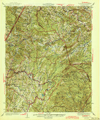
~ Linville NC topo map, 1:62500 scale, 15 X 15 Minute, Historical, 1944
Linville, North Carolina, USGS topographic map dated 1944.
Includes geographic coordinates (latitude and longitude). This topographic map is suitable for hiking, camping, and exploring, or framing it as a wall map.
Printed on-demand using high resolution imagery, on heavy weight and acid free paper, or alternatively on a variety of synthetic materials.
Topos available on paper, Waterproof, Poly, or Tyvek. Usually shipping rolled, unless combined with other folded maps in one order.
- Product Number: USGS-5374576
- Free digital map download (high-resolution, GeoPDF): Linville, North Carolina (file size: 13 MB)
- Map Size: please refer to the dimensions of the GeoPDF map above
- Weight (paper map): ca. 55 grams
- Map Type: POD USGS Topographic Map
- Map Series: HTMC
- Map Verison: Historical
- Cell ID: 56757
- Scan ID: 162889
- Woodland Tint: Yes
- Survey Year: 1935
- Datum: NAD27
- Map Projection: Polyconic
- Map published by Tennessee Valley Authority
- Map Language: English
- Scanner Resolution: 600 dpi
- Map Cell Name: Linville
- Grid size: 15 X 15 Minute
- Date on map: 1944
- Map Scale: 1:62500
- Geographical region: North Carolina, United States
Neighboring Maps:
All neighboring USGS topo maps are available for sale online at a variety of scales.
Spatial coverage:
Topo map Linville, North Carolina, covers the geographical area associated the following places:
- Kellerville - Crossnore - Dark Ridge (historical) - Chestnut Dale - Seven Devils - Cherokee Woods - Cranberry Gap - Edgemont - Farmer Mill - Sugar Mountain - Vilas - Elk Valley - Hughes - Carpenter Bottom - Pineola - Norwood Hollow - Vale - Valle Crucis - Heaton - Valley Creek - Roseborough - Battleground - Elk Park - Beech Mountain - Stamey Town - Mount Pleasant - Newland - Matney - Cranberry - Pyatte - Foscoe - Whaley - Poga - Banner Elk - Montezuma - Hemlock Ridge - Grandfather - Buck Mountain - Balm - Rominger - Mill Ridge - Gragg - Minneapolis - Linville
- Map Area ID: AREA36.2536-82-81.75
- Northwest corner Lat/Long code: USGSNW36.25-82
- Northeast corner Lat/Long code: USGSNE36.25-81.75
- Southwest corner Lat/Long code: USGSSW36-82
- Southeast corner Lat/Long code: USGSSE36-81.75
- Northern map edge Latitude: 36.25
- Southern map edge Latitude: 36
- Western map edge Longitude: -82
- Eastern map edge Longitude: -81.75


