
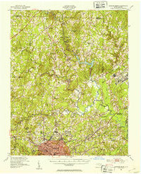
~ Durham North NC topo map, 1:62500 scale, 15 X 15 Minute, Historical, 1951, updated 1953
Durham North, North Carolina, USGS topographic map dated 1951.
Includes geographic coordinates (latitude and longitude). This topographic map is suitable for hiking, camping, and exploring, or framing it as a wall map.
Printed on-demand using high resolution imagery, on heavy weight and acid free paper, or alternatively on a variety of synthetic materials.
Topos available on paper, Waterproof, Poly, or Tyvek. Usually shipping rolled, unless combined with other folded maps in one order.
- Product Number: USGS-5374442
- Free digital map download (high-resolution, GeoPDF): Durham North, North Carolina (file size: 10 MB)
- Map Size: please refer to the dimensions of the GeoPDF map above
- Weight (paper map): ca. 55 grams
- Map Type: POD USGS Topographic Map
- Map Series: HTMC
- Map Verison: Historical
- Cell ID: 53621
- Scan ID: 162428
- Imprint Year: 1953
- Woodland Tint: Yes
- Aerial Photo Year: 1943
- Edit Year: 1951
- Datum: NAD27
- Map Projection: Polyconic
- Map published by United States Army Corps of Engineers
- Map Language: English
- Scanner Resolution: 600 dpi
- Map Cell Name: Durham North
- Grid size: 15 X 15 Minute
- Date on map: 1951
- Map Scale: 1:62500
- Geographical region: North Carolina, United States
Neighboring Maps:
All neighboring USGS topo maps are available for sale online at a variety of scales.
Spatial coverage:
Topo map Durham North, North Carolina, covers the geographical area associated the following places:
- Fox Run - Marywood - Heritage Heights - Braggtown - Fairntosh - The American Village - Fieldstream - Rocky Knoll - Huckleberry Spring - Bahama - Red Mountain - Huntington Place - Cozart - Greymoss - Willardville - Heather Glen - Havenhill - Glen Forest - Forest Acres - Butner - Orange Factory - Hampton - West Hills - Archer Woods - Rougemont - Redwood - Weaver - West Hills East - Quail Roost - Mill Grove - Burton - Mangum Store - Gorman - Willow Ridge - Spring Valley - Meadow Estates - Pleasant Green Estates - Suntree - Knap of Reeds - University Estates
- Map Area ID: AREA36.2536-79-78.75
- Northwest corner Lat/Long code: USGSNW36.25-79
- Northeast corner Lat/Long code: USGSNE36.25-78.75
- Southwest corner Lat/Long code: USGSSW36-79
- Southeast corner Lat/Long code: USGSSE36-78.75
- Northern map edge Latitude: 36.25
- Southern map edge Latitude: 36
- Western map edge Longitude: -79
- Eastern map edge Longitude: -78.75


