
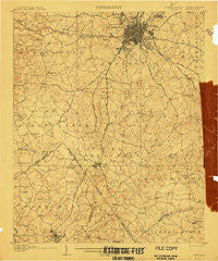
~ Charlotte NC topo map, 1:62500 scale, 15 X 15 Minute, Historical, 1907
Charlotte, North Carolina, USGS topographic map dated 1907.
Includes geographic coordinates (latitude and longitude). This topographic map is suitable for hiking, camping, and exploring, or framing it as a wall map.
Printed on-demand using high resolution imagery, on heavy weight and acid free paper, or alternatively on a variety of synthetic materials.
Topos available on paper, Waterproof, Poly, or Tyvek. Usually shipping rolled, unless combined with other folded maps in one order.
- Product Number: USGS-5374404
- Free digital map download (high-resolution, GeoPDF): Charlotte, North Carolina (file size: 9 MB)
- Map Size: please refer to the dimensions of the GeoPDF map above
- Weight (paper map): ca. 55 grams
- Map Type: POD USGS Topographic Map
- Map Series: HTMC
- Map Verison: Historical
- Cell ID: 52443
- Scan ID: 161723
- Visual Version Number: 2
- Survey Year: 1905
- Datum: Unstated
- Map Projection: Unstated
- Map published by United States Geological Survey
- Map Language: English
- Scanner Resolution: 600 dpi
- Map Cell Name: Charlotte
- Grid size: 15 X 15 Minute
- Date on map: 1907
- Map Scale: 1:62500
- Geographical region: North Carolina, United States
Neighboring Maps:
All neighboring USGS topo maps are available for sale online at a variety of scales.
Spatial coverage:
Topo map Charlotte, North Carolina, covers the geographical area associated the following places:
- Old Providence - Taragate Farms - Tuckaway Park - Charlotte - British Woods - Oakhurst - Berryhill - Yorkmount Park - Glenwood - Belmont - Country Roads - Beverly Woods East - Chantilly - Lebanon Heights - Sedgefield - Wynnwood - Carmel Park - Winterfield - Huntlynn Acres - Providence - Enderly Park - Old Farm - Olde Whitehall - Colony Acres - Steelberry Acres - Southpark - Huntingtowne Farms - Barclay Downs - Hebron (historical) - Wesley Heights - Montclaire South - Ramblewood - Darby Acres - Fox Run - Olde Providence - Kanawha Hills - Dilworth - Coventry Woods - Fort Mill - Olympic Woods - Banalsburg (historical) - Catawba Colony - Kingswood - Foxcroft - Olde Georgetowne - Third Ward - Singing Springs - Shannon Park - Dixie - Windsor Park - Grier Heights - Providence Woods - Lockewood - Midwood - Sterling - Sardis Oaks - Spring Valley - The Cloisters - Steele Creek - Yorkmont - Biddleville - Providence Plantation - Barberville - Raintree - Twelve Oaks - Clayton Park - Old Orchid - Brandon - Westmoreland - Rama - White Hall (historical) - Pineville - Camp Cox - Colonial Village - Montclaire - Woodberry Forest - Olde Heritage - Cherry - Hampton Leas - Quail Hollow - Parkview East - Stonehaven - Whiteville Park - Carmel - Wilmore - Colonial Heights - Selwyn Park - Parkwood - Eden Gardens - Ravenwood - Forest Lake - Grey Rock - Fairmeadows - Sardis - Beverly Woods - Southbourne - Sherwood Forest - Falcon Bridge - North Charlotte - Westerly Hill
- Map Area ID: AREA35.2535-81-80.75
- Northwest corner Lat/Long code: USGSNW35.25-81
- Northeast corner Lat/Long code: USGSNE35.25-80.75
- Southwest corner Lat/Long code: USGSSW35-81
- Southeast corner Lat/Long code: USGSSE35-80.75
- Northern map edge Latitude: 35.25
- Southern map edge Latitude: 35
- Western map edge Longitude: -81
- Eastern map edge Longitude: -80.75


