
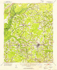
~ Chadbourn NC topo map, 1:62500 scale, 15 X 15 Minute, Historical, 1953, updated 1955
Chadbourn, North Carolina, USGS topographic map dated 1953.
Includes geographic coordinates (latitude and longitude). This topographic map is suitable for hiking, camping, and exploring, or framing it as a wall map.
Printed on-demand using high resolution imagery, on heavy weight and acid free paper, or alternatively on a variety of synthetic materials.
Topos available on paper, Waterproof, Poly, or Tyvek. Usually shipping rolled, unless combined with other folded maps in one order.
- Product Number: USGS-5374398
- Free digital map download (high-resolution, GeoPDF): Chadbourn, North Carolina (file size: 7 MB)
- Map Size: please refer to the dimensions of the GeoPDF map above
- Weight (paper map): ca. 55 grams
- Map Type: POD USGS Topographic Map
- Map Series: HTMC
- Map Verison: Historical
- Cell ID: 52345
- Scan ID: 164154
- Imprint Year: 1955
- Woodland Tint: Yes
- Aerial Photo Year: 1951
- Survey Year: 1953
- Datum: NAD27
- Map Projection: Polyconic
- Map published by United States Geological Survey
- Map Language: English
- Scanner Resolution: 600 dpi
- Map Cell Name: Chadbourn
- Grid size: 15 X 15 Minute
- Date on map: 1953
- Map Scale: 1:62500
- Geographical region: North Carolina, United States
Neighboring Maps:
All neighboring USGS topo maps are available for sale online at a variety of scales.
Spatial coverage:
Topo map Chadbourn, North Carolina, covers the geographical area associated the following places:
- Nobles Crossing - Hickmans Crossroads - Bird Cage - Cerro Gordo - Piney Forest Crossroads - Evergreen - Powells Crossing - Potters Curve - Braswell - Wyatts Crossroads - Grist - Williams Cross Roads (historical) - Williamson Crossroads - Cedar Grove - Chadbourn - Wards - Oak Dale Crossroads - Peacocks - Frink Crossing - Broadway - Mount Olive - Fipps Crossing - Boardman - Lennons Crossroads - Hinson Crossroads
- Map Area ID: AREA34.534.25-79-78.75
- Northwest corner Lat/Long code: USGSNW34.5-79
- Northeast corner Lat/Long code: USGSNE34.5-78.75
- Southwest corner Lat/Long code: USGSSW34.25-79
- Southeast corner Lat/Long code: USGSSE34.25-78.75
- Northern map edge Latitude: 34.5
- Southern map edge Latitude: 34.25
- Western map edge Longitude: -79
- Eastern map edge Longitude: -78.75


