
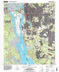
~ Wilmington NC topo map, 1:24000 scale, 7.5 X 7.5 Minute, Historical, 1993, updated 1999
Wilmington, North Carolina, USGS topographic map dated 1993.
Includes geographic coordinates (latitude and longitude). This topographic map is suitable for hiking, camping, and exploring, or framing it as a wall map.
Printed on-demand using high resolution imagery, on heavy weight and acid free paper, or alternatively on a variety of synthetic materials.
Topos available on paper, Waterproof, Poly, or Tyvek. Usually shipping rolled, unless combined with other folded maps in one order.
- Product Number: USGS-5374162
- Free digital map download (high-resolution, GeoPDF): Wilmington, North Carolina (file size: 16 MB)
- Map Size: please refer to the dimensions of the GeoPDF map above
- Weight (paper map): ca. 55 grams
- Map Type: POD USGS Topographic Map
- Map Series: HTMC
- Map Verison: Historical
- Cell ID: 49292
- Scan ID: 161796
- Imprint Year: 1999
- Woodland Tint: Yes
- Aerial Photo Year: 1993
- Datum: NAD83
- Map Projection: Universal Transverse Mercator
- Map published by United States Geological Survey
- Map Language: English
- Scanner Resolution: 600 dpi
- Map Cell Name: Wilmington
- Grid size: 7.5 X 7.5 Minute
- Date on map: 1993
- Map Scale: 1:24000
- Geographical region: North Carolina, United States
Neighboring Maps:
All neighboring USGS topo maps are available for sale online at a variety of scales.
Spatial coverage:
Topo map Wilmington, North Carolina, covers the geographical area associated the following places:
- Charter Oaks Mobile Home Park - Pine Terrace Mobile Home Park - Greenbriar - Azalea Mobile Home Park - Lake Forest - Hinsons Mobile Home Park - Lincoln Forest - Ponderosa Mobile Home Park - Delgado - Wilmington - Devon Park - Clairmont - Marquis Hills - South Oleander - Barclay Hills - Arrowhead - Myrtle Grove - Myrtle Grove Junction - Silver Lake - Peachtree Mobile Home Park - Belville - Langleys Mobile Home Park Number 2 - Royal Palms Mobile Home Park - Pine Valley Estates - Winter Park - Glen Meade - Silver Lake Mobile Home Park - Forest Hills - Grove Park Mobile Home Estates - Riverfront Mobile Home Park - Princess Place - Baldwin Estates Mobile Home Park - Fairlawn - Bowdens Mobile Home Park - Maple Avenue Mobile Home Park - Echo Farms - Grants Mobile Home Park - Sunset Park - Old Town
- Map Area ID: AREA34.2534.125-78-77.875
- Northwest corner Lat/Long code: USGSNW34.25-78
- Northeast corner Lat/Long code: USGSNE34.25-77.875
- Southwest corner Lat/Long code: USGSSW34.125-78
- Southeast corner Lat/Long code: USGSSE34.125-77.875
- Northern map edge Latitude: 34.25
- Southern map edge Latitude: 34.125
- Western map edge Longitude: -78
- Eastern map edge Longitude: -77.875


