
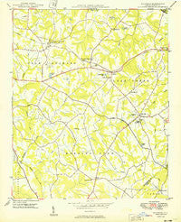
~ Wilgrove NC topo map, 1:24000 scale, 7.5 X 7.5 Minute, Historical, 1949
Wilgrove, North Carolina, USGS topographic map dated 1949.
Includes geographic coordinates (latitude and longitude). This topographic map is suitable for hiking, camping, and exploring, or framing it as a wall map.
Printed on-demand using high resolution imagery, on heavy weight and acid free paper, or alternatively on a variety of synthetic materials.
Topos available on paper, Waterproof, Poly, or Tyvek. Usually shipping rolled, unless combined with other folded maps in one order.
- Product Number: USGS-5374134
- Free digital map download (high-resolution, GeoPDF): Wilgrove, North Carolina (file size: 7 MB)
- Map Size: please refer to the dimensions of the GeoPDF map above
- Weight (paper map): ca. 55 grams
- Map Type: POD USGS Topographic Map
- Map Series: HTMC
- Map Verison: Historical
- Cell ID: 29587
- Scan ID: 164015
- Woodland Tint: Yes
- Aerial Photo Year: 1948
- Field Check Year: 1948
- Datum: NAD27
- Map Projection: Polyconic
- Planimetric: Yes
- Map published by United States Geological Survey
- Map Language: English
- Scanner Resolution: 600 dpi
- Map Cell Name: Mint Hill
- Grid size: 7.5 X 7.5 Minute
- Date on map: 1949
- Map Scale: 1:24000
- Geographical region: North Carolina, United States
Neighboring Maps:
All neighboring USGS topo maps are available for sale online at a variety of scales.
Spatial coverage:
Topo map Wilgrove, North Carolina, covers the geographical area associated the following places:
- Tarawoods - Lakeland Hills - Planters Ridge - Danbrooke Park - Idelwile Brooke - Timber Ridge - Wilgrove - Lake Haven - Farmwood - Country Woods - Eastwoods - Idlewild - Ravenwood - Holiday Park - Olde Savannah - Kingwood (historical) - Wood Hollow - Silverstone - Lawyers Station - Windrow Estates - Embassy East - Hickory Grove - Burdett (historical) - Wyndemere Crossing - Holly Hills - Idlewild Farms - Forest Homes - Wildwoods - Mint Hill - Spicewood Acres - Morning Star Acres - Hickory Ridge - Homestead - Morris Park - Fairfield Plantation - Sardis Patio - Lake Forest - Sardis Woods - Devonshire - Kinghurst Park - Cedar Brook - Heathergate - Olde Creek - Four Seasons - Manchester - Hoods - Grove Park - Deerhurst - Easthaven - Hope Park - Idlewood Acres - Thompson Plantation - Kolewood - Wilson Wood - Apple Creek - Orville (historical) - Heatherwood - Orchard Knoll - Timber Creek - Suburban Woods - Mint Hollow - Robinson Church Community - Sharon Forest - Reigate - Hickory Acres - Orchard Park - Marlwood Acre - Statewood
- Map Area ID: AREA35.2535.125-80.75-80.625
- Northwest corner Lat/Long code: USGSNW35.25-80.75
- Northeast corner Lat/Long code: USGSNE35.25-80.625
- Southwest corner Lat/Long code: USGSSW35.125-80.75
- Southeast corner Lat/Long code: USGSSE35.125-80.625
- Northern map edge Latitude: 35.25
- Southern map edge Latitude: 35.125
- Western map edge Longitude: -80.75
- Eastern map edge Longitude: -80.625


