
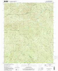
~ Luftee Knob NC topo map, 1:24000 scale, 7.5 X 7.5 Minute, Historical, 2000, updated 2001
Luftee Knob, North Carolina, USGS topographic map dated 2000.
Includes geographic coordinates (latitude and longitude). This topographic map is suitable for hiking, camping, and exploring, or framing it as a wall map.
Printed on-demand using high resolution imagery, on heavy weight and acid free paper, or alternatively on a variety of synthetic materials.
Topos available on paper, Waterproof, Poly, or Tyvek. Usually shipping rolled, unless combined with other folded maps in one order.
- Product Number: USGS-5371690
- Free digital map download (high-resolution, GeoPDF): Luftee Knob, North Carolina (file size: 17 MB)
- Map Size: please refer to the dimensions of the GeoPDF map above
- Weight (paper map): ca. 55 grams
- Map Type: POD USGS Topographic Map
- Map Series: HTMC
- Map Verison: Historical
- Cell ID: 26927
- Scan ID: 161578
- Imprint Year: 2001
- Woodland Tint: Yes
- Photo Inspection Year: 2000
- Aerial Photo Year: 2000
- Datum: NAD27
- Map Projection: Lambert Conformal Conic
- Map published by United States Geological Survey
- Map Language: English
- Scanner Resolution: 600 dpi
- Map Cell Name: Luftee Knob
- Grid size: 7.5 X 7.5 Minute
- Date on map: 2000
- Map Scale: 1:24000
- Geographical region: North Carolina, United States
Neighboring Maps:
All neighboring USGS topo maps are available for sale online at a variety of scales.
Spatial coverage:
Topo map Luftee Knob, North Carolina, covers the geographical area associated the following places:
- Mouse Creek - Sunup Knob - Camel Hump Knob - Sugar Cove Campsite - Little Nettle Branch - Oskodah Branch - Mount Yonaguska - Slide Branch - Laurel Gap Branch - Mount Sterling Ridge - Swallow Fork - Inadu Knob - Rocky Branch - Indian Ridge - Snake Den Mountain - Walnut Bottom - Beech Gap - Chestnut Cove Creek - Turkey Pen Branch - Beech Creek - Yellow Creek - John Mack Creek - Beech Ridge - Cosby Knob - Inadu Mountain - Marks Knob - Rocky Face Mountain - Camel Hump Mountain - Flint Rock Cove - Thermo Knob - Thumper Branch - Gray Camp Branch - Trap Branch - Williamson Cemetery - Red Oak Cove - Nettle Branch - Thermo Branch - Table Rock Branch - Laurel Gap - Dans Branch - Byrd Branch - Low Gap Branch - Cooks Creek - Big Butt - Butt Mountain - Sevenmile Beech Ridge - Trail Ridge - Bettis Branch - Dry Branch - Sinking Creek - Ledge Bald - Mc Gee Spring - Falling Rock Creek - Inadu Creek - Township of Cataloochee - Laurel Gap Shelter - Pretty Hollow Creek - Gunter Fork - Lynn Camp Branch - Balsam Mountain - Pin Oak Gap - Manse Branch - Onion Bed Branch - Camel Hump Creek - Balsam Corner - Yellow Creek Gap - Barnes Branch - Mc Ginty Creek - Grass Branch - Poplar Cove - Thicket Branch - Balsam Corner Creek - Mouse Creek Falls - Balsam High Top - Big Head Branch - Brakeshoe Spring - Hyatt Ridge - Kahneska Branch - Deer Creek - Low Gap - Snakeden Mountain Campsite - Luftee Knob - Shawano Ridge - Lost Bottom Creek - Miller Branch - Pretty Hollow Gap - Roses Gap - Big Cataloochee Mountain - Little Rock Creek - Prophet Branch - Dasohga Ridge - Indian Knob - Roses Branch - Camel Gap - Walnut Bottoms Cemetery - Hyatt Bald - Cosby Knob Shelter - Good Spring Branch - Ross Knob - Kilby Branch
- Map Area ID: AREA35.7535.625-83.25-83.125
- Northwest corner Lat/Long code: USGSNW35.75-83.25
- Northeast corner Lat/Long code: USGSNE35.75-83.125
- Southwest corner Lat/Long code: USGSSW35.625-83.25
- Southeast corner Lat/Long code: USGSSE35.625-83.125
- Northern map edge Latitude: 35.75
- Southern map edge Latitude: 35.625
- Western map edge Longitude: -83.25
- Eastern map edge Longitude: -83.125


