
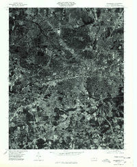
~ Greensboro NC topo map, 1:24000 scale, 7.5 X 7.5 Minute, Historical, 1977, updated 1979
Greensboro, North Carolina, USGS topographic map dated 1977.
Includes geographic coordinates (latitude and longitude). This topographic map is suitable for hiking, camping, and exploring, or framing it as a wall map.
Printed on-demand using high resolution imagery, on heavy weight and acid free paper, or alternatively on a variety of synthetic materials.
Topos available on paper, Waterproof, Poly, or Tyvek. Usually shipping rolled, unless combined with other folded maps in one order.
- Product Number: USGS-5370782
- Free digital map download (high-resolution, GeoPDF): Greensboro, North Carolina (file size: 22 MB)
- Map Size: please refer to the dimensions of the GeoPDF map above
- Weight (paper map): ca. 55 grams
- Map Type: POD USGS Topographic Map
- Map Series: HTMC
- Map Verison: Historical
- Cell ID: 18426
- Scan ID: 162533
- Imprint Year: 1979
- Aerial Photo Year: 1977
- Datum: NAD27
- Map Projection: Lambert Conformal Conic
- Orthophoto: Quad
- Map published by United States Geological Survey
- Keywords: Nonstandard Press Run
- Map Language: English
- Scanner Resolution: 600 dpi
- Map Cell Name: Greensboro
- Grid size: 7.5 X 7.5 Minute
- Date on map: 1977
- Map Scale: 1:24000
- Geographical region: North Carolina, United States
Neighboring Maps:
All neighboring USGS topo maps are available for sale online at a variety of scales.
Spatial coverage:
Topo map Greensboro, North Carolina, covers the geographical area associated the following places:
- Broadview - Shannon Woods - Green Valley - Friendly Acres - Dudley Heights - Rankin - Cumberland - Bluford Heights - O Henry Oaks - Shannon Hills - Forest Valley - Pennydale - Southmont - Westbury - Lindley Park - Rocky Knoll - Edgeville - Latham Town - Westwood - Green Tree - Lincoln Heights - McAdoo Heights - Oak Grove - White Oak - Warnersville - Dellwood Park - The Pines - Pomona - Brookwood Gardens - Proximity - Clinton Hills - Fairfield - Spring Valley - Vandalia - Carriage Hills - Hamilton Forest - Kirkwood - Friendly Homes - Lawndale Homes - Revolution - Rolling Roads - Sunset Hills - Terra Cotta - Greenfield - Latham Park - Hunter Hills - Fisher Park - Lake Daniel - Scott Park - Hamilton Lakes - Westridge Heights - Irving Park - Starmount Forest - Woodlea - Smith Homes - Sedgefield Park - Hamilton Hills - Highland Park West - Nocho Park - British Woods - Westerwood - Woodlea Lakes - Piedmont Heights - Sedge-Town - Guilford Hills - East White Oak - Hillsdale Park - Greenhaven - Garden Homes - Greensboro - Oakwood - Random Woods - Pinecroft - Meadowood Homes - Glenwood
- Map Area ID: AREA36.12536-79.875-79.75
- Northwest corner Lat/Long code: USGSNW36.125-79.875
- Northeast corner Lat/Long code: USGSNE36.125-79.75
- Southwest corner Lat/Long code: USGSSW36-79.875
- Southeast corner Lat/Long code: USGSSE36-79.75
- Northern map edge Latitude: 36.125
- Southern map edge Latitude: 36
- Western map edge Longitude: -79.875
- Eastern map edge Longitude: -79.75


