
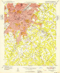
~ Charlotte East NC topo map, 1:24000 scale, 7.5 X 7.5 Minute, Historical, 1949
Charlotte East, North Carolina, USGS topographic map dated 1949.
Includes geographic coordinates (latitude and longitude). This topographic map is suitable for hiking, camping, and exploring, or framing it as a wall map.
Printed on-demand using high resolution imagery, on heavy weight and acid free paper, or alternatively on a variety of synthetic materials.
Topos available on paper, Waterproof, Poly, or Tyvek. Usually shipping rolled, unless combined with other folded maps in one order.
- Product Number: USGS-5369594
- Free digital map download (high-resolution, GeoPDF): Charlotte East, North Carolina (file size: 12 MB)
- Map Size: please refer to the dimensions of the GeoPDF map above
- Weight (paper map): ca. 55 grams
- Map Type: POD USGS Topographic Map
- Map Series: HTMC
- Map Verison: Historical
- Cell ID: 8228
- Scan ID: 164167
- Woodland Tint: Yes
- Aerial Photo Year: 1948
- Field Check Year: 1948
- Datum: NAD27
- Map Projection: Polyconic
- Planimetric: Yes
- Map published by United States Geological Survey
- Map Language: English
- Scanner Resolution: 600 dpi
- Map Cell Name: Charlotte East
- Grid size: 7.5 X 7.5 Minute
- Date on map: 1949
- Map Scale: 1:24000
- Geographical region: North Carolina, United States
Neighboring Maps:
All neighboring USGS topo maps are available for sale online at a variety of scales.
Spatial coverage:
Topo map Charlotte East, North Carolina, covers the geographical area associated the following places:
- Singing Springs - Mayfair - Sharon Colony - Providence Woods - North Charlotte - Beverly Woods - Sardis Oaks - Barclay Downs - Darby Acres - Bishops Ridge - Montclaire - Hebron (historical) - Greenville - Belmont - Robinson Woods - Sherwood Forest - Colonial Heights - Rama - Selwyn Park - Chantilly - Grier Heights - Huntingtowne Farms - Carmel Woods - Sardis Cove - Cotswold - Midwood - Parkview East - Brandon - Eastfield - The Cloisters - Myers Park - Pellyn Wood - Rosemont - Foxcroft - Stonehaven - Elizabeth - Beverly Woods East - Coventry Woods - Providence Park - Parkstone - Dilworth - Biddleville - Severville - Hampton Leas - Spring Valley - Villa Heights - Southpark - Wynnwood - Shannon Park - Winterfield - Sardis - Third Ward - Woodbridge - Castleton Gardens - Sedgefield - Windsor Park - Lockewood - Charlotte - Woodberry Forest - Fox Run - Glenwood - Old Farm - Fourth Ward - Waverly Hall - Carmel - Old Providence - Carmel Park - Eastover - Oakhurst - Old Salem - Country Roads - Mountain Brook - Starmount - Wilmore - Currituck - Olde Heritage - Olde Georgetowne - Queens Grant - Fairmeadows - Wesley Heights - Cherry - Landsdowne
- Map Area ID: AREA35.2535.125-80.875-80.75
- Northwest corner Lat/Long code: USGSNW35.25-80.875
- Northeast corner Lat/Long code: USGSNE35.25-80.75
- Southwest corner Lat/Long code: USGSSW35.125-80.875
- Southeast corner Lat/Long code: USGSSE35.125-80.75
- Northern map edge Latitude: 35.25
- Southern map edge Latitude: 35.125
- Western map edge Longitude: -80.875
- Eastern map edge Longitude: -80.75


