
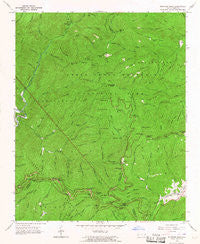
~ Bunches Bald NC topo map, 1:24000 scale, 7.5 X 7.5 Minute, Historical, 1964, updated 1967
Bunches Bald, North Carolina, USGS topographic map dated 1964.
Includes geographic coordinates (latitude and longitude). This topographic map is suitable for hiking, camping, and exploring, or framing it as a wall map.
Printed on-demand using high resolution imagery, on heavy weight and acid free paper, or alternatively on a variety of synthetic materials.
Topos available on paper, Waterproof, Poly, or Tyvek. Usually shipping rolled, unless combined with other folded maps in one order.
- Product Number: USGS-5369350
- Free digital map download (high-resolution, GeoPDF): Bunches Bald, North Carolina (file size: 15 MB)
- Map Size: please refer to the dimensions of the GeoPDF map above
- Weight (paper map): ca. 55 grams
- Map Type: POD USGS Topographic Map
- Map Series: HTMC
- Map Verison: Historical
- Cell ID: 6188
- Scan ID: 164250
- Imprint Year: 1967
- Woodland Tint: Yes
- Aerial Photo Year: 1963
- Field Check Year: 1964
- Datum: NAD27
- Map Projection: Polyconic
- Map published by United States Geological Survey
- Map Language: English
- Scanner Resolution: 600 dpi
- Map Cell Name: Bunches Bald
- Grid size: 7.5 X 7.5 Minute
- Date on map: 1964
- Map Scale: 1:24000
- Geographical region: North Carolina, United States
Neighboring Maps:
All neighboring USGS topo maps are available for sale online at a variety of scales.
Spatial coverage:
Topo map Bunches Bald, North Carolina, covers the geographical area associated the following places:
- Flat Creek Bald - Redman Ridge - Spruce Mountain Ridge - Locust Knob - Potato Hill Bald - George Ira Creek - Horse Camp - Rough Ridge - Bunches Gap - Indian Creek - Maggot Spring Gap - Bear Branch - Big Cove - Lickstone Ridge Tunnel - Ravens Roost Ridge - Plott Ridge - Bunches Bald Tunnel - Madcap Branch - Horsetrough Ridge - Straight Fork Raven Fork - Mile High Overlook - Flat Creek Falls - Masonic Monument - Horsetrough Ridge Overlook - Sugartree Licks - Deep Gap Branch - Hyatt Creek - Big Witch Overlook - Heintooga Bald - Plott Balsam Overlook - Bunches Bald Overlook - Shanty Mountain - Big Cove Mission - Little Ridge - Flat Creek - Skidder Branch - Balsam Mountain Campground - Big Ridge - Overlook Ridge - Strawberry Knob - John Henry Camp Creek - Little Spruce Ridge - Spread Branch - Wolf Laurel Branch - Quillaree Branch - Bunches Bald - Black Camp Gap - Wolf Cove Creek - Flat Creek Campsite - Jones Creek - Redman Creek - Horse Creek Gap - Black Camp Branch - Chestnut Ridge - Maggot Ridge - Rock Camp Run - Pleasant Branch - Heintooga Creek - Mollie Gap - Tooni Branch - Horse Creek - Cataloochee Balsam - Jenkins Ridge Overlook - Wycle Fork - Jonathan Creek Overlook - Right Fork Redman Creek - Heintooga Ridge - Docks Gap - Spruce Mountain - Round Bottom Creek - Messer Fork - Heintooga Overlook - Big Witch Gap - Brown Lead - Left Fork Redman Creek - Warm Cove Branch - Chiltoes Mountain - Big Witch Tunnel - Dobson Ridge - Big Fork Ridge - Sheepback Knob - McGhee Cemetery - Round Bottom Campground - Peachtree Church - Wash Ridge - Moody Branch - Board Cove Branch - Stillwell Creek - Woody Ridge - Lickstone Overlook - Flat Bald Branch - Ledge Creek - Wolf Laurel Gap - Hurricane Creek - Right Prong Ledge Creek - Selma Creek - Long Branch - Brushy Gap - Woody Creek - Barnett Knob
- Map Area ID: AREA35.62535.5-83.25-83.125
- Northwest corner Lat/Long code: USGSNW35.625-83.25
- Northeast corner Lat/Long code: USGSNE35.625-83.125
- Southwest corner Lat/Long code: USGSSW35.5-83.25
- Southeast corner Lat/Long code: USGSSE35.5-83.125
- Northern map edge Latitude: 35.625
- Southern map edge Latitude: 35.5
- Western map edge Longitude: -83.25
- Eastern map edge Longitude: -83.125


