
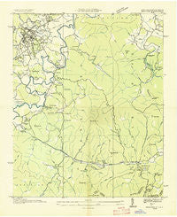
~ Brevard NC topo map, 1:24000 scale, 7.5 X 7.5 Minute, Historical, 1935
Brevard, North Carolina, USGS topographic map dated 1935.
Includes geographic coordinates (latitude and longitude). This topographic map is suitable for hiking, camping, and exploring, or framing it as a wall map.
Printed on-demand using high resolution imagery, on heavy weight and acid free paper, or alternatively on a variety of synthetic materials.
Topos available on paper, Waterproof, Poly, or Tyvek. Usually shipping rolled, unless combined with other folded maps in one order.
- Product Number: USGS-5369266
- Free digital map download (high-resolution, GeoPDF): Brevard, North Carolina (file size: 8 MB)
- Map Size: please refer to the dimensions of the GeoPDF map above
- Weight (paper map): ca. 55 grams
- Map Type: POD USGS Topographic Map
- Map Series: HTMC
- Map Verison: Historical
- Cell ID: 5367
- Scan ID: 163794
- Woodland Tint: Yes
- Field Check Year: 1935
- Datum: NAD27
- Map Projection: Polyconic
- Advance: Yes
- Planimetric: Yes
- Map published by Tennessee Valley Authority
- Map Language: English
- Scanner Resolution: 600 dpi
- Map Cell Name: Brevard
- Grid size: 7.5 X 7.5 Minute
- Date on map: 1935
- Map Scale: 1:24000
- Geographical region: North Carolina, United States
Neighboring Maps:
All neighboring USGS topo maps are available for sale online at a variety of scales.
Spatial coverage:
Topo map Brevard, North Carolina, covers the geographical area associated the following places:
- Sherwood Ridge - Emerald Hills Estates - Franklin Park - Sherwood Terrace - Hidden Valley - Glen Cannon - Forest Hills - Hamilton Estates - Pine Shore Lakes - Sequoyah Woods - Fernwood - Stoney Brook - Knob Ridge - Happy Acres - Knob Creek - Slick Rock - Pisgah Forest Farms - Deerwoods Estates - Sweetwater Farms - Brevard - Morgan Heights - Sherwood Forest - Connestee Falls - Loehencove Ridge - Seven Springs - Knob Hill - Cedar Mountain - Patton Mountain Estates - Falls Creek - Millbrook Estates - Dunns Rock - Broadview Estates - Riverside Estates - Seeshore - Blue Ridge Overlook - McCrary Acres - North Brevard - Little River - Ducktown
- Map Area ID: AREA35.2535.125-82.75-82.625
- Northwest corner Lat/Long code: USGSNW35.25-82.75
- Northeast corner Lat/Long code: USGSNE35.25-82.625
- Southwest corner Lat/Long code: USGSSW35.125-82.75
- Southeast corner Lat/Long code: USGSSE35.125-82.625
- Northern map edge Latitude: 35.25
- Southern map edge Latitude: 35.125
- Western map edge Longitude: -82.75
- Eastern map edge Longitude: -82.625


