
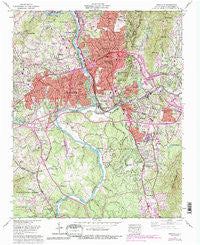
~ Asheville NC topo map, 1:24000 scale, 7.5 X 7.5 Minute, Historical, 1961, updated 1993
Asheville, North Carolina, USGS topographic map dated 1961.
Includes geographic coordinates (latitude and longitude). This topographic map is suitable for hiking, camping, and exploring, or framing it as a wall map.
Printed on-demand using high resolution imagery, on heavy weight and acid free paper, or alternatively on a variety of synthetic materials.
Topos available on paper, Waterproof, Poly, or Tyvek. Usually shipping rolled, unless combined with other folded maps in one order.
- Product Number: USGS-5368888
- Free digital map download (high-resolution, GeoPDF): Asheville, North Carolina (file size: 19 MB)
- Map Size: please refer to the dimensions of the GeoPDF map above
- Weight (paper map): ca. 55 grams
- Map Type: POD USGS Topographic Map
- Map Series: HTMC
- Map Verison: Historical
- Cell ID: 1641
- Scan ID: 161868
- Imprint Year: 1993
- Woodland Tint: Yes
- Photo Revision Year: 1991
- Aerial Photo Year: 1987
- Edit Year: 1991
- Field Check Year: 1961
- Datum: Unstated
- Map Projection: Polyconic
- Map published by Tennessee Valley Authority
- Map Language: English
- Scanner Resolution: 600 dpi
- Map Cell Name: Asheville
- Grid size: 7.5 X 7.5 Minute
- Date on map: 1961
- Map Scale: 1:24000
- Geographical region: North Carolina, United States
Neighboring Maps:
All neighboring USGS topo maps are available for sale online at a variety of scales.
Spatial coverage:
Topo map Asheville, North Carolina, covers the geographical area associated the following places:
- Linwood Park - Oakley - Sulphur Springs - Albemarle - Mountainbrook - Beverly Hills - Hazel Green - Asheville - Wilshire Park - Valley Springs - Bent Creek - Biltmore - Malvern Hills - Rolling Green - Rosebank Park - Wind Oaks Town Homes - Dogwood Grove - Haw Creek - Echo Hills - Buena Vista - Redwood Village - Venable - Venable Community - Camelot - Sayles Village - Spring Time - Deaver View - Brooklawn Park - Shiloh - Emma - Lee Walker Hots - Kenilworth - Stockwood - Hawthorne - Broadview - Knollwood - Pisgah View - West Asheville - Montford Hills - Hillcrest Apts - Woolsey - Highland Gate - Boswell - Murphy Junction - East Biltmore - Happy Valley - Bingham Heights - Biltmore Forest
- Map Area ID: AREA35.62535.5-82.625-82.5
- Northwest corner Lat/Long code: USGSNW35.625-82.625
- Northeast corner Lat/Long code: USGSNE35.625-82.5
- Southwest corner Lat/Long code: USGSSW35.5-82.625
- Southeast corner Lat/Long code: USGSSE35.5-82.5
- Northern map edge Latitude: 35.625
- Southern map edge Latitude: 35.5
- Western map edge Longitude: -82.625
- Eastern map edge Longitude: -82.5


