
~ Salisbury MD topo map, 1:250000 scale, 1 X 2 Degree, Historical, 1946, updated 1975
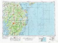
Salisbury, Maryland, USGS topographic map dated 1946.
Includes geographic coordinates (latitude and longitude). This topographic map is suitable for hiking, camping, and exploring, or framing it as a wall map.
Printed on-demand using high resolution imagery, on heavy weight and acid free paper, or alternatively on a variety of synthetic materials.
Topos available on paper, Waterproof, Poly, or Tyvek. Usually shipping rolled, unless combined with other folded maps in one order.
- Product Number: USGS-5368756
- Free digital map download (high-resolution, GeoPDF): Salisbury, Maryland (file size: 21 MB)
- Map Size: please refer to the dimensions of the GeoPDF map above
- Weight (paper map): ca. 55 grams
- Map Type: POD USGS Topographic Map
- Map Series: HTMC
- Map Verison: Historical
- Cell ID: 74990
- Scan ID: 257781
- Imprint Year: 1975
- Woodland Tint: Yes
- Edit Year: 1969
- Datum: Unstated
- Map Projection: Transverse Mercator
- Map published by United States Geological Survey
- Map Language: English
- Scanner Resolution: 600 dpi
- Map Cell Name: Salisbury
- Grid size: 1 X 2 Degree
- Date on map: 1946
- Map Scale: 1:250000
- Geographical region: Maryland, United States
Neighboring Maps:
All neighboring USGS topo maps are available for sale online at a variety of scales.
Spatial coverage:
Topo map Salisbury, Maryland, covers the geographical area associated the following places:
- The Island - Rum Ridge Estates - Stockton - Lakeview Estates - Greenlea Acres - Lewis Corner - Hillsboro - Pine Manor Estates - Ferry Landing - Waples Pond Acres - County Seat Gardens Mobile Home Park - Bottom Hills - Polk Road - Boonsboro - Foggy Bottom - Sea Colony East - Piney Grove Manor - Schellenger Landing - Silver Lake Mobile Home Park - Collins Creek Estates - Bestpitch - Scottsdale Park Mobile Home Park - Nanticoke Estates - Lynn Lee Village Mobile Home Park - Timberlake - Hollyville Acres - Johnson Development - Old Landing - Ellendale - Webb Manor - The Shoals - Washington Heights - Mallard Point - Whaleys Crossroads - Federalsburg - Lakewood Development - Rehoboth Shores Mobile Home Park - John Walstons Mobile Home Park - Scotts Corner - Murray Estates - Foxchase - Grove - Melvins Crossroads - White Horse Farm - Paris Woods - Albatross Mobile Home Park - Chestnut Hill - South Milford (historical) - Fenwick Estates - Dogwood Village - Colonial Acres - Hickman - Atlanta Estates - Wellington Estates - Delmar - Belmont - Hickman Village Estates Mobile Home Park - Riverview Gardens - New Market - Whiteleysburg - Parkview - Elliott - North Milford (historical) - Seabright - Waterview - Roxford - Westwood - Mount Olive Manor - Choptank Overlook - Shaft Ox Corner - Park Manor - Tessie-Maringola Estates - Horseshoe Estates - Waljacks Corners - Belle Haven - Dogwood Meadows - Norfolk Downs - Pine Ridge - Shiloh Manor - Nanticoke Acres - Rogers Development - Nelpine Mobile Home Park - Truitts Park - Collins and Russell Development - Westover - Bridgeville North - Bossard Property - Sandy Landing - Clarksons Crossroads - Tall Timbers Park - Hotton Acres - Sussex Woods - Country Club Estates - Rockawalking Acres - Leonard Farm - Oak Grove - Shingle Landing - Hummingbird Hills - Haven Lake Estates - Pittsville Manor
- Map Area ID: AREA3938-76-74
- Northwest corner Lat/Long code: USGSNW39-76
- Northeast corner Lat/Long code: USGSNE39-74
- Southwest corner Lat/Long code: USGSSW38-76
- Southeast corner Lat/Long code: USGSSE38-74
- Northern map edge Latitude: 39
- Southern map edge Latitude: 38
- Western map edge Longitude: -76
- Eastern map edge Longitude: -74


