
~ Salisbury MD topo map, 1:250000 scale, 1 X 2 Degree, Historical, 1961
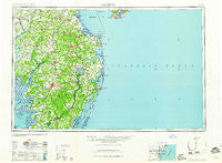
Salisbury, Maryland, USGS topographic map dated 1961.
Includes geographic coordinates (latitude and longitude). This topographic map is suitable for hiking, camping, and exploring, or framing it as a wall map.
Printed on-demand using high resolution imagery, on heavy weight and acid free paper, or alternatively on a variety of synthetic materials.
Topos available on paper, Waterproof, Poly, or Tyvek. Usually shipping rolled, unless combined with other folded maps in one order.
- Product Number: USGS-5368752
- Free digital map download (high-resolution, GeoPDF): Salisbury, Maryland (file size: 13 MB)
- Map Size: please refer to the dimensions of the GeoPDF map above
- Weight (paper map): ca. 55 grams
- Map Type: POD USGS Topographic Map
- Map Series: HTMC
- Map Verison: Historical
- Cell ID: 74990
- Scan ID: 257778
- Woodland Tint: Yes
- Datum: Unstated
- Map Projection: Transverse Mercator
- Map published by United States Geological Survey
- Map Language: English
- Scanner Resolution: 600 dpi
- Map Cell Name: Salisbury
- Grid size: 1 X 2 Degree
- Date on map: 1961
- Map Scale: 1:250000
- Geographical region: Maryland, United States
Neighboring Maps:
All neighboring USGS topo maps are available for sale online at a variety of scales.
Spatial coverage:
Topo map Salisbury, Maryland, covers the geographical area associated the following places:
- Crooked Oak - Lazy Lake - Fenwick West - Pomona Heights - Riverdale - Eagles Nest Mobile Home Park - Mount Joy - Swann Keys - Wil-e-lew - Summit - Pine Grove - Maple Plains - Woods Edge - Libertytown - Windyhill - Robinsonville - Nentego Manor - Lewis Landing - Smithwood Manor - Cottage Grove - Holly Grove - Lakewood - Mount Olive Manor - Ellendale - Rehoboth Beach - Buck Landing - Bridgeville North - Catchpenny - Sewell Mills - Angola Crest II Mobile Home Park - Massey Landing - Philmore Park - Saint Stephen - Finchville - Somerset - Fairmount - Greenland - Westview - Montego Bay Mobile Home Park - Suburban Acres - Ellegood Estates - Riding Acres - River-view Acres - Poplar Neck - Federalsburg - Mobile Gardens Mobile Home Park - Potters Landing - Tanyard - Gum Crossroads - Whiton - Douglynn Farms - Helms Landing - Jones Crossroads - Heritage Manor - Sierra Manor - Venton - Craigs Mill - Friendship - Conley Chapel Village Mobile Home Park - Shortly - Haven Lake Estates - Gull Point - Steele Acres - Kings Crossroads - Bethlehem - Foggy Bottom - Costen - Pine Grove - Little Georgetown - Fisher Mill Park - Petersburg - Morris Mobile Home Park - Moonglow Manor - Tower Mobile Home Park - Puncheon Landing - Coulborn Mill Valley - Sea Air Mobile Home Park - Belltown - Abbotts Mill - Oriole - Stonehedge Estates - Broadkill Beach - Holly Hill - Truitt - Wellington Estates - Erma - Lakewood - West Beach - Nichols - Cantebury Apartments - Hawkeye - Green Ridge Mobile Home Park - I and I Mobile Home Park - Sussex Estates - Beaver Dam Acres - Cocked Hat - Baileys Landing - Passapae Landing - Buck Hill Landing - Highland Acres
- Map Area ID: AREA3938-76-74
- Northwest corner Lat/Long code: USGSNW39-76
- Northeast corner Lat/Long code: USGSNE39-74
- Southwest corner Lat/Long code: USGSSW38-76
- Southeast corner Lat/Long code: USGSSE38-74
- Northern map edge Latitude: 39
- Southern map edge Latitude: 38
- Western map edge Longitude: -76
- Eastern map edge Longitude: -74


