
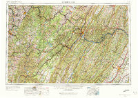
~ Cumberland MD topo map, 1:250000 scale, 1 X 2 Degree, Historical, 1956, updated 1972
Cumberland, Maryland, USGS topographic map dated 1956.
Includes geographic coordinates (latitude and longitude). This topographic map is suitable for hiking, camping, and exploring, or framing it as a wall map.
Printed on-demand using high resolution imagery, on heavy weight and acid free paper, or alternatively on a variety of synthetic materials.
Topos available on paper, Waterproof, Poly, or Tyvek. Usually shipping rolled, unless combined with other folded maps in one order.
- Product Number: USGS-5368744
- Free digital map download (high-resolution, GeoPDF): Cumberland, Maryland (file size: 27 MB)
- Map Size: please refer to the dimensions of the GeoPDF map above
- Weight (paper map): ca. 55 grams
- Map Type: POD USGS Topographic Map
- Map Series: HTMC
- Map Verison: Historical
- Cell ID: 68734
- Scan ID: 257773
- Imprint Year: 1972
- Woodland Tint: Yes
- Aerial Photo Year: 1952
- Edit Year: 1969
- Field Check Year: 1956
- Datum: Unstated
- Map Projection: Transverse Mercator
- Map published by United States Geological Survey
- Map Language: English
- Scanner Resolution: 600 dpi
- Map Cell Name: Cumberland
- Grid size: 1 X 2 Degree
- Date on map: 1956
- Map Scale: 1:250000
- Geographical region: Maryland, United States
Neighboring Maps:
All neighboring USGS topo maps are available for sale online at a variety of scales.
Spatial coverage:
Topo map Cumberland, Maryland, covers the geographical area associated the following places:
- Berrett (historical) - Nikep - South Uniontown - Bloomington - Sylvan - Capon Lake - Cohill Estates - Pierpont - Morris Crossroads - Hardesty - Kennells Mill - Rosendorf - Woodland - Austen - Asher Glade - Zepp - Brady - Coal Run - Goodtown - Hutton - Burning Knolls - Amblersburg - Fairmor - Bradshaw (historical) - Seymourville - Park Head - Hudson - Calhoun - Sea Right - Davis - Greater Point Marion - McNeill - Glen Savage - White Post - Hendricks - Ruthbelle - Mount Pisgah - Coolspring - Savage - Comps Crossroads - Capon Springs - Stephenson - Burk - Stringtown - Indian Creek - New Creek - Cumberland Heights - Maple Run - Union Corner - Factory Hill - Pinkerton - Homewood - Mount Hope - Deer Park - Eckhart Junction - Mexico - Towson (historical) - Cabaniss - Tunnelton - Hibbs - Bel Air - Glencoe - Wrights (historical) - Leisenring - Birds Creek - Oakland - Stevensburg - Adah - Allegany Grove - Auvil - Mineral Spring - Furnace Hill - Keyser - Indian Hollow - Keisterville - Tyrone - Johnsons Mill - Sitka - Wilmoth (historical) - Bloomery - Berlin - Mill Run (historical) - West Virginia Central Junction - Philson - High View Manor - Furnace (historical) - College Park - Shoaf - Yeakle Mill - Bayard - Star City - Colebank - Bethelboro - Wittenberg - Stotlers Crossroads - Heritage Hills - Green Spring - Rush - Camp Ground - Walker
- Map Area ID: AREA4039-80-78
- Northwest corner Lat/Long code: USGSNW40-80
- Northeast corner Lat/Long code: USGSNE40-78
- Southwest corner Lat/Long code: USGSSW39-80
- Southeast corner Lat/Long code: USGSSE39-78
- Northern map edge Latitude: 40
- Southern map edge Latitude: 39
- Western map edge Longitude: -80
- Eastern map edge Longitude: -78


