
~ Cumberland MD topo map, 1:250000 scale, 1 X 2 Degree, Historical, 1956, updated 1966
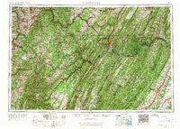
Cumberland, Maryland, USGS topographic map dated 1956.
Includes geographic coordinates (latitude and longitude). This topographic map is suitable for hiking, camping, and exploring, or framing it as a wall map.
Printed on-demand using high resolution imagery, on heavy weight and acid free paper, or alternatively on a variety of synthetic materials.
Topos available on paper, Waterproof, Poly, or Tyvek. Usually shipping rolled, unless combined with other folded maps in one order.
- Product Number: USGS-5368742
- Free digital map download (high-resolution, GeoPDF): Cumberland, Maryland (file size: 28 MB)
- Map Size: please refer to the dimensions of the GeoPDF map above
- Weight (paper map): ca. 55 grams
- Map Type: POD USGS Topographic Map
- Map Series: HTMC
- Map Verison: Historical
- Cell ID: 68734
- Scan ID: 257771
- Imprint Year: 1966
- Woodland Tint: Yes
- Edit Year: 1966
- Field Check Year: 1956
- Datum: Unstated
- Map Projection: Transverse Mercator
- Map published by United States Geological Survey
- Map Language: English
- Scanner Resolution: 600 dpi
- Map Cell Name: Cumberland
- Grid size: 1 X 2 Degree
- Date on map: 1956
- Map Scale: 1:250000
- Geographical region: Maryland, United States
Neighboring Maps:
All neighboring USGS topo maps are available for sale online at a variety of scales.
Spatial coverage:
Topo map Cumberland, Maryland, covers the geographical area associated the following places:
- Wickham - Clear Brook - Bismarck - Niver Junction - Maidsville - The Knolls - Timber Ridge - Golden Fleece Estates - Ridgeley - Flat Rock - Charlestown - De Haveland Estates - Mountain Falls Park - Fairview - Rainsburg - Wabash (historical) - Rolling Fields - Freeport - Bel Air - Gravel Hill - Furnace Hill - Bellegrove - Bretz - Upper Peanut - Lap - Five Forks - Apple View Estates - Thayerville - Footedale - Deer Park - Brewer Hill - The Flatts - Flora (historical) - McNeill - Ringgold - Leith - Hazelhurst - Bowling Green - Hambleton - Lakewood Acres - East End - Burnt Factory - Rock Forge - Rocks Works - Reservoir Hill - Puritan - Stotlers Crossroads - Rockville - Shaft - Mount Hope - Sand Spring - Salisbury Junction - Hogue Creek Estates - Devland Estates - Arensburg - Suncrest - Skyline - Hazen - Koontzville - Selbysport - Myers (historical) - Kearney - Intermont - Vannoys Mill - Zar (historical) - Macomber - Anderson - Bittinger - Franklin - Cunningham - Fairmor - Saratoga - Point Marion - Cranesville - Fort Run - Brookhaven - Midlothian - Sell - Amcelle Acres - Marvania Heights - Snider - Piedmont - New Moatsville (historical) - Burlington - Sabraton - Elk - Sitka - Stanley - Lardin - Adah - Hatfield - Brotherton - Cove Run Station (historical) - Braddock Hills Estates - Breedlove (historical) - Roberts - Florence (historical) - Mount Independence - Sutherland (historical) - Lake Ford
- Map Area ID: AREA4039-80-78
- Northwest corner Lat/Long code: USGSNW40-80
- Northeast corner Lat/Long code: USGSNE40-78
- Southwest corner Lat/Long code: USGSSW39-80
- Southeast corner Lat/Long code: USGSSE39-78
- Northern map edge Latitude: 40
- Southern map edge Latitude: 39
- Western map edge Longitude: -80
- Eastern map edge Longitude: -78


