
~ Baltimore MD topo map, 1:250000 scale, 1 X 2 Degree, Historical, 1956
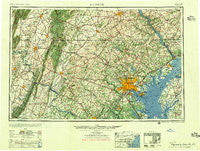
Baltimore, Maryland, USGS topographic map dated 1956.
Includes geographic coordinates (latitude and longitude). This topographic map is suitable for hiking, camping, and exploring, or framing it as a wall map.
Printed on-demand using high resolution imagery, on heavy weight and acid free paper, or alternatively on a variety of synthetic materials.
Topos available on paper, Waterproof, Poly, or Tyvek. Usually shipping rolled, unless combined with other folded maps in one order.
- Product Number: USGS-5368728
- Free digital map download (high-resolution, GeoPDF): Baltimore, Maryland (file size: 25 MB)
- Map Size: please refer to the dimensions of the GeoPDF map above
- Weight (paper map): ca. 55 grams
- Map Type: POD USGS Topographic Map
- Map Series: HTMC
- Map Verison: Historical
- Cell ID: 74996
- Scan ID: 257765
- Woodland Tint: Yes
- Aerial Photo Year: 1944
- Datum: NAD27
- Map Projection: Transverse Mercator
- Map published by United States Army Corps of Engineers
- Map published by United States Army
- Map Language: English
- Scanner Resolution: 600 dpi
- Map Cell Name: Baltimore
- Grid size: 1 X 2 Degree
- Date on map: 1956
- Map Scale: 1:250000
- Geographical region: Maryland, United States
Neighboring Maps:
All neighboring USGS topo maps are available for sale online at a variety of scales.
Spatial coverage:
Topo map Baltimore, Maryland, covers the geographical area associated the following places:
- Brooklyn Manor - Hall Shop Estates - Janwood - Vicmyer Vista - Oak Orchard - Westbury - Browns Corner - Stevenson Park - Bradley Hills Grove - Red Bridge - Kinhart Manor - Bethel - West Frederick Highlands - Old Town - High Barbaree - Bancroft - Lawndale - Hammarlee - Holland Acres - Campus Green - Dill - Moxley - The Bluffs - White Oak Estates - Parkridge Estates - Altogether - Wilna - Greenbrier - Sharewood Acres - South Gate - Hathaway - Cedonia - Roseville Heights - Texas - Stonehaven - Quince Orchard Manor - Pond Bank - Oak Ridge - Water Acres - Georges Mill - Ebbvale Estates - Glade Town - Valley Overlook - Tydings on the Bay - Bird Hill Estates - Carroll Island - Woodville - Mission Heights - Asberry (historical) - Braddock Estates - Sky View - Triadelphia (historical) - Riverside - Christophers Crossing - Concord - Huntington - Mill Brothers Hills - Highland - Berndell Estates - Virginia Mills - Winands Valley Estates - Linden - Academy Lane - Cabin River Farms - Jacobsville - Nova - Stratton Woods - Drexel - Oak Ridge - Greystone Farms - Quince Orchard Knolls - Jarrettswood - Overlook - Wakefield - Silver Crest - Lake Shore - West Middletown Estates - Sycolin - Harford Village - Garrison Ridge - Knepper - Rosedale - Point-O-Woods - Courts of Harford Square - Mountville Manor - Catoctin View - Dayspring Estates - Roundtree - Glen Forney - Polo Club Estates - Lightners Tract - Timber Point - Tuscarora Springs - Aldino - New Midway - Glenbauer - Old Farm - Baronet Woods - Pondsville - Hidden Hills
- Map Area ID: AREA4039-78-76
- Northwest corner Lat/Long code: USGSNW40-78
- Northeast corner Lat/Long code: USGSNE40-76
- Southwest corner Lat/Long code: USGSSW39-78
- Southeast corner Lat/Long code: USGSSE39-76
- Northern map edge Latitude: 40
- Southern map edge Latitude: 39
- Western map edge Longitude: -78
- Eastern map edge Longitude: -76


