
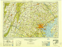
~ Baltimore MD topo map, 1:250000 scale, 1 X 2 Degree, Historical, 1948, updated 1950
Baltimore, Maryland, USGS topographic map dated 1948.
Includes geographic coordinates (latitude and longitude). This topographic map is suitable for hiking, camping, and exploring, or framing it as a wall map.
Printed on-demand using high resolution imagery, on heavy weight and acid free paper, or alternatively on a variety of synthetic materials.
Topos available on paper, Waterproof, Poly, or Tyvek. Usually shipping rolled, unless combined with other folded maps in one order.
- Product Number: USGS-5368724
- Free digital map download (high-resolution, GeoPDF): Baltimore, Maryland (file size: 20 MB)
- Map Size: please refer to the dimensions of the GeoPDF map above
- Weight (paper map): ca. 55 grams
- Map Type: POD USGS Topographic Map
- Map Series: HTMC
- Map Verison: Historical
- Cell ID: 74996
- Scan ID: 257763
- Imprint Year: 1950
- Woodland Tint: Yes
- Aerial Photo Year: 1944
- Datum: NAD27
- Map Projection: Transverse Mercator
- Map published by United States Army Corps of Engineers
- Map published by United States Army
- Map Language: English
- Scanner Resolution: 600 dpi
- Map Cell Name: Baltimore
- Grid size: 1 X 2 Degree
- Date on map: 1948
- Map Scale: 1:250000
- Geographical region: Maryland, United States
Neighboring Maps:
All neighboring USGS topo maps are available for sale online at a variety of scales.
Spatial coverage:
Topo map Baltimore, Maryland, covers the geographical area associated the following places:
- Stratton Woods - Epping Farms - Damascus Valley Estates - Timberline - Hamilton Heights - Triadelphia Woods - Spring Valley Mobile Home Park - Carriage Hills - Curtis Acres - Tuscarora Springs - Clear View - Springwood - Presidential Park - York Furnace - Islands of Balmoral - Sharrer Heights - Meadowbrook - Ridgefield - Trinity Farms - Knollcrest Farms - Lake Forest - Wyndham Woods - Woods - Summit Park - Lyndale - Darnestown Knolls - Coseytown - Quail Hills - Liberty Manor - Bowleys Quarters - Paulson - Brookside Forest - Shookstown Heights - Nottingham - Noble Mill - Highland View - North Farm - Henekes Corner - Stonehedge - Hemlock Ridge - Harshman Estates - Greenwood Manor - Folly Farms - Rosedale - Westchester Square - Sycamore Springs - Lapidum - West Dale Park - Ridgecroft - Waterford - Floradale - Mount Augustine - Wayside Estates - Lake View - My Ladies Manor - Rocky Springs - Latigo Trails - Waibelwood Park - Evergreen Park - Poulsen Heights - Sanandrews - Bachman Valley Estates - Beechersville - Chesmar - Mount Carmel - Canton - Square Corner - Tolchester Beach - Plumtree Estates - Uniontown - Tanglewood - Mounts Scenic Acres - Silver Run Estates - Hudson Heights - Twin Brook Estates - Pleasant Acres - Blueberry Heights - Hazelmoor - Saint James Village - Jackson - Happy Acres - Greenbrier Hills - Trevanion - Northgate - Harewood - Patapsco - Yoe - Yorkleigh - Lineboro - Spring Valley - Saint Johns Green - Dunloggin - Kings Charter - Springbrook - Level - Grandview Heights - Butler - Conowingo Village - Settlers Landing - Benroy
- Map Area ID: AREA4039-78-76
- Northwest corner Lat/Long code: USGSNW40-78
- Northeast corner Lat/Long code: USGSNE40-76
- Southwest corner Lat/Long code: USGSSW39-78
- Southeast corner Lat/Long code: USGSSE39-76
- Northern map edge Latitude: 40
- Southern map edge Latitude: 39
- Western map edge Longitude: -78
- Eastern map edge Longitude: -76


