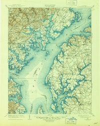
~ Tolchester MD topo map, 1:125000 scale, 30 X 30 Minute, Historical, 1908, updated 1944
Tolchester, Maryland, USGS topographic map dated 1908.
Includes geographic coordinates (latitude and longitude). This topographic map is suitable for hiking, camping, and exploring, or framing it as a wall map.
Printed on-demand using high resolution imagery, on heavy weight and acid free paper, or alternatively on a variety of synthetic materials.
Topos available on paper, Waterproof, Poly, or Tyvek. Usually shipping rolled, unless combined with other folded maps in one order.
- Product Number: USGS-5368720
- Free digital map download (high-resolution, GeoPDF): Tolchester, Maryland (file size: 10 MB)
- Map Size: please refer to the dimensions of the GeoPDF map above
- Weight (paper map): ca. 55 grams
- Map Type: POD USGS Topographic Map
- Map Series: HTMC
- Map Verison: Historical
- Cell ID: 66795
- Scan ID: 257761
- Imprint Year: 1944
- Survey Year: 1902
- Datum: Unstated
- Map Projection: Polyconic
- Map published by United States Geological Survey
- Map Language: English
- Scanner Resolution: 600 dpi
- Map Cell Name: Tolchester
- Grid size: 30 X 30 Minute
- Date on map: 1908
- Map Scale: 1:125000
- Geographical region: Maryland, United States
Neighboring Maps:
All neighboring USGS topo maps are available for sale online at a variety of scales.
Spatial coverage:
Topo map Tolchester, Maryland, covers the geographical area associated the following places:
- Wrights Mobile Home Village - Still Pond - Catts Corner - Sylvania Mobile Home Park - Hassengers Corner - Blakeford - Tree Tops - Lou Mar Estates - Harford Square - Port Cherry Gardens Farm - Cliffs City - Kings Court - Country Walk - Catlin (historical) - Baker - Green Springs Hills - Woodland Run - Orchard View - Carrollwood Manor - Bear Creek Junction - Chapel Valley - Village of Bynum Run - Reeses Corner - Perryvale - Langford Acres - Henekes Corner - Perry's Mobile Home Park - Milburn on the Magothy - Seneca Park - Great Meadows - Corsica Landing Estates - Whitemarsh Estates - Oaklyn Manor - Woodward Square - Sylvan View - White Marsh - Bush - Scholar Woods - Plumtree Estates - Browns Woods Villa - Silver Meadow - Country Ridge - Barrington - Necker - Burrisville - Glenmar - Chapel Manor - Walnut Ridge - Silvergate East - Joppa View - Reba L Anthony Estates - Ventnor Forest - Southeast Landing - Bayside Beach - Chesapeake Oaks - Harewood Park - Wildwood - Kingston Estates - Coventry Farms - White Banks - Pine Crest West - Old Mill Bottom Estates - Glenmar Manor - Chester Harbor - Cedarside Farm - Clearview - Harford Commons - Glenbauer - Forge Acres - Fairview - Weatherly - Riverside Village of Church Creek - Exeter Green - Ferguson Meadows - Pinehurst on the Bodkin - Silver Spring Station - Bonaparte Estates - Wilna - Becks Landing - Oakmont - Rossville - Morgnec - Tall Timbers Estates - Perrywood - Indian Princess - Baywood Mobile Home Park - Dundee Village - Kingswood - Brierwood - Delta Heights - Marys Choice - Woodbridge Center - Dorado Hills - Bynum Overlook - Long Bar Harbor - Cole (historical) - Darryl Gardens - Calvert Heights - Peppermint Woods Mobile Home Park - Goose Hollow
- Map Area ID: AREA39.539-76.5-76
- Northwest corner Lat/Long code: USGSNW39.5-76.5
- Northeast corner Lat/Long code: USGSNE39.5-76
- Southwest corner Lat/Long code: USGSSW39-76.5
- Southeast corner Lat/Long code: USGSSE39-76
- Northern map edge Latitude: 39.5
- Southern map edge Latitude: 39
- Western map edge Longitude: -76.5
- Eastern map edge Longitude: -76


