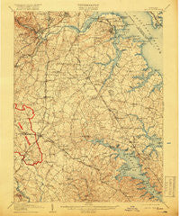
~ Relay MD topo map, 1:62500 scale, 15 X 15 Minute, Historical, 1907, updated 1918
Relay, Maryland, USGS topographic map dated 1907.
Includes geographic coordinates (latitude and longitude). This topographic map is suitable for hiking, camping, and exploring, or framing it as a wall map.
Printed on-demand using high resolution imagery, on heavy weight and acid free paper, or alternatively on a variety of synthetic materials.
Topos available on paper, Waterproof, Poly, or Tyvek. Usually shipping rolled, unless combined with other folded maps in one order.
- Product Number: USGS-5368510
- Free digital map download (high-resolution, GeoPDF): Relay, Maryland (file size: 10 MB)
- Map Size: please refer to the dimensions of the GeoPDF map above
- Weight (paper map): ca. 55 grams
- Map Type: POD USGS Topographic Map
- Map Series: HTMC
- Map Verison: Historical
- Cell ID: 61548
- Scan ID: 257648
- Imprint Year: 1918
- Survey Year: 1905
- Datum: Unstated
- Map Projection: Unstated
- Map published by United States Geological Survey
- Map Language: English
- Scanner Resolution: 600 dpi
- Map Cell Name: Relay
- Grid size: 15 X 15 Minute
- Date on map: 1907
- Map Scale: 1:62500
- Geographical region: Maryland, United States
Neighboring Maps:
All neighboring USGS topo maps are available for sale online at a variety of scales.
Spatial coverage:
Topo map Relay, Maryland, covers the geographical area associated the following places:
- Indian Creek Estates - Patapsco - Raynor Heights - Water Oak Point - Dorrs Corner - Twin Ridge - Foxhollow - Curtis Bay - Saint Denis - Lehigh - Bendale - Acresville - Courts of Crofton - McPherson - Grove Ridge - Margate - Stevenson Park - Ross Cove - Severn Lea - Spring Fields - Manhattan Manor - East Brooklyn - Glendale Terrace - Shipley - Epping Farms - Belvedere Heights - Mago Vista Beach - Gapgalleon - Brooklyn Park - Bar Harbor Manor - Revell - Shirley Estates - Oak Grove - Lennox Park - Glenmore - Ferndale - Kingston Heights - Riverdale - Bohemia Beach - Conaways - View Point - Sandridge - Turner - Villa Bella - Longmeadow North - School Gardens - Berrywood West - Washington Crest Heights - Villa Verdi - Roland Terrace - Harbor Valley Estates - Towering Oaks - Elmhurst Estates - Severna Park - Wedgewood Forest - Solley - Delmont - Cape Arthur - Kings Ransom - Parkwood - Southgate - Woodlawn Heights - Crofton Highlands - Aurora Hills - Arbordale - Timber Ridge - Stoney View - Lake Riviera - Palisades Park - The Timbers - Crestwood - Sandy Oaks - Windrush Farm - Carrollton Manor - Mallet Hill - Wellington - Maid Marion - Woodcrest - Sanders Park - Sunnyview Acres - Shannon Square - Garland - Orchard Gate at Piney Orchard - Alberta Heights - Hidden Hills - English Consul - Montgomery Manor - Clear Water Beach - Tebbston - Yorktown - Severn Mills - Arbour Manor - Grand View Park - Terrace View Mobile Estates - Robinson - South Gate - Oak Park - Glen Cove Estates - High Point - Greentree
- Map Area ID: AREA39.2539-76.75-76.5
- Northwest corner Lat/Long code: USGSNW39.25-76.75
- Northeast corner Lat/Long code: USGSNE39.25-76.5
- Southwest corner Lat/Long code: USGSSW39-76.75
- Southeast corner Lat/Long code: USGSSE39-76.5
- Northern map edge Latitude: 39.25
- Southern map edge Latitude: 39
- Western map edge Longitude: -76.75
- Eastern map edge Longitude: -76.5


