
~ Oakland MD topo map, 1:62500 scale, 15 X 15 Minute, Historical, 1899, updated 1961
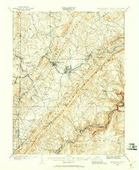
Oakland, Maryland, USGS topographic map dated 1899.
Includes geographic coordinates (latitude and longitude). This topographic map is suitable for hiking, camping, and exploring, or framing it as a wall map.
Printed on-demand using high resolution imagery, on heavy weight and acid free paper, or alternatively on a variety of synthetic materials.
Topos available on paper, Waterproof, Poly, or Tyvek. Usually shipping rolled, unless combined with other folded maps in one order.
- Product Number: USGS-5368372
- Free digital map download (high-resolution, GeoPDF): Oakland, Maryland (file size: 10 MB)
- Map Size: please refer to the dimensions of the GeoPDF map above
- Weight (paper map): ca. 55 grams
- Map Type: POD USGS Topographic Map
- Map Series: HTMC
- Map Verison: Historical
- Cell ID: 60448
- Scan ID: 257553
- Imprint Year: 1961
- Survey Year: 1899
- Datum: NAD27
- Map Projection: Polyconic
- Map published by United States Geological Survey
- Map Language: English
- Scanner Resolution: 600 dpi
- Map Cell Name: Oakland
- Grid size: 15 X 15 Minute
- Date on map: 1899
- Map Scale: 1:62500
- Geographical region: Maryland, United States
Neighboring Maps:
All neighboring USGS topo maps are available for sale online at a variety of scales.
Spatial coverage:
Topo map Oakland, Maryland, covers the geographical area associated the following places:
- Kearney - Hazelhurst - Deer Park - Hutton - Corinth - Bradshaw (historical) - Oakland - Loch Lynn Heights - Redhouse - Gortner - Skipnish (historical) - Wallman - Turner Douglass - Berrett (historical) - Mitchell Manor - Crellin - Wilson - Fort Pendleton - Wilson - Schell - Mountain Lake Park - Gormania - Steyer - Green Glade - Herrington Manor - Sunnyside - Silver Lake - Gorman - Bayard - Altamont - Fricks Crossing
- Map Area ID: AREA39.539.25-79.5-79.25
- Northwest corner Lat/Long code: USGSNW39.5-79.5
- Northeast corner Lat/Long code: USGSNE39.5-79.25
- Southwest corner Lat/Long code: USGSSW39.25-79.5
- Southeast corner Lat/Long code: USGSSE39.25-79.25
- Northern map edge Latitude: 39.5
- Southern map edge Latitude: 39.25
- Western map edge Longitude: -79.5
- Eastern map edge Longitude: -79.25


