
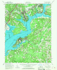
~ Indian Head MD topo map, 1:62500 scale, 15 X 15 Minute, Historical, 1956, updated 1968
Indian Head, Maryland, USGS topographic map dated 1956.
Includes geographic coordinates (latitude and longitude). This topographic map is suitable for hiking, camping, and exploring, or framing it as a wall map.
Printed on-demand using high resolution imagery, on heavy weight and acid free paper, or alternatively on a variety of synthetic materials.
Topos available on paper, Waterproof, Poly, or Tyvek. Usually shipping rolled, unless combined with other folded maps in one order.
- Product Number: USGS-5368262
- Free digital map download (high-resolution, GeoPDF): Indian Head, Maryland (file size: 9 MB)
- Map Size: please refer to the dimensions of the GeoPDF map above
- Weight (paper map): ca. 55 grams
- Map Type: POD USGS Topographic Map
- Map Series: HTMC
- Map Verison: Historical
- Cell ID: 55740
- Scan ID: 257491
- Imprint Year: 1968
- Woodland Tint: Yes
- Aerial Photo Year: 1955
- Field Check Year: 1956
- Datum: NAD27
- Map Projection: Polyconic
- Map published by United States Geological Survey
- Map published by United States Army Corps of Engineers
- Map published by United States Army
- Map Language: English
- Scanner Resolution: 600 dpi
- Map Cell Name: Indian Head
- Grid size: 15 X 15 Minute
- Date on map: 1956
- Map Scale: 1:62500
- Geographical region: Maryland, United States
Neighboring Maps:
All neighboring USGS topo maps are available for sale online at a variety of scales.
Spatial coverage:
Topo map Indian Head, Maryland, covers the geographical area associated the following places:
- Freedom Village - North Accokeek - Highland Estates - North Indian Head Estates - Port Tobacco Riviera - Rollingwood - Gunston Heights - Holly Haven - Mount Vernon Woods - Raceway Farms - Mattawoman Woods - Redhill Estates - Featherstone Shores - Kimberly Woods - Waldon Woods - Gum Springs - Calvert Manor - Mattawoman Village - Fort Washington Estates - Robie Manor - Jones View - Riverview - Glymont - Berry Hill Manor - Tantallon Square - Riverwood - Friendship Estates - Montrose - Snowden - Woodlawn Manor - Strawberry Hills Estates - Stratford Landing - Port Tobacco Lakes - Sunnyview - Hybla Valley - Oakwood - Springfield Oaks - Yacht Haven - Port Tobacco Hills - Caernarvon Woods - Knotts Crossing - Tantallon Hills - Ellerslie Heights - Rison Acres - Myrtle Grove Estates - Lorton - Marbury - Eutaw Forest - Port Tobacco - Perry Wright - Mount Pisgah - Tarrington Creek - Riverside Gardens - Fenwick - Accokeek - Warington Hills - Mount Vernon - Pomonkey - Potomac Wood - Tauxenent (historical) - Accokeek Lawn - Avon Crest - Potomac Heights - Southwood - Belmont Park - Arcturus - Woodley Hills - Stratford on the Potomac - Graystone Estates - Riverside Estates - Bellevue Estates - Laurel Acres - Mount Carmel Estates - Pomfret Estates - Battersea on the Bay - Rison - Columbia Park - Sulgrave Manor - Laurel Branch - Bennsville - Hunter - Newington - Pisgah - Farmington Road Estates - Laurel Hill - Woodbridge - Ayres - Schuyler Hills - South Hampton Village - Wessynton - Ripley - Mount Vernon Manor - Vernon Square - Buteaux Crossing - Tantallon North - Chapel Acres - King George Estates - Pomonkey Landing - Simmons Acres - Newton Woods
- Map Area ID: AREA38.7538.5-77.25-77
- Northwest corner Lat/Long code: USGSNW38.75-77.25
- Northeast corner Lat/Long code: USGSNE38.75-77
- Southwest corner Lat/Long code: USGSSW38.5-77.25
- Southeast corner Lat/Long code: USGSSE38.5-77
- Northern map edge Latitude: 38.75
- Southern map edge Latitude: 38.5
- Western map edge Longitude: -77.25
- Eastern map edge Longitude: -77


