
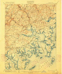
~ Gunpowder MD topo map, 1:62500 scale, 15 X 15 Minute, Historical, 1901, updated 1915
Gunpowder, Maryland, USGS topographic map dated 1901.
Includes geographic coordinates (latitude and longitude). This topographic map is suitable for hiking, camping, and exploring, or framing it as a wall map.
Printed on-demand using high resolution imagery, on heavy weight and acid free paper, or alternatively on a variety of synthetic materials.
Topos available on paper, Waterproof, Poly, or Tyvek. Usually shipping rolled, unless combined with other folded maps in one order.
- Product Number: USGS-5368200
- Free digital map download (high-resolution, GeoPDF): Gunpowder, Maryland (file size: 9 MB)
- Map Size: please refer to the dimensions of the GeoPDF map above
- Weight (paper map): ca. 55 grams
- Map Type: POD USGS Topographic Map
- Map Series: HTMC
- Map Verison: Historical
- Cell ID: 54940
- Scan ID: 257448
- Imprint Year: 1915
- Survey Year: 1900
- Datum: Unstated
- Map Projection: Unstated
- Map published by United States Geological Survey
- Map Language: English
- Scanner Resolution: 600 dpi
- Map Cell Name: Gunpowder
- Grid size: 15 X 15 Minute
- Date on map: 1901
- Map Scale: 1:62500
- Geographical region: Maryland, United States
Neighboring Maps:
All neighboring USGS topo maps are available for sale online at a variety of scales.
Spatial coverage:
Topo map Gunpowder, Maryland, covers the geographical area associated the following places:
- Peppermint Woods Mobile Home Park - Perry View - Woodbridge Center - Edgewater Village - Silver Meadow - Biscayne Bay Village - Glenmar Manor - Perryvale - Valley View - Bengies - Mars Estates - Northwind Farms - The Timbers - Joppa Vale - The Meadows - Indian Princess - Philadelphia Station - Hartland Village - Oaklyn Manor - Richlyn Manor - Pinedale - Eagle Nest - Reckford - Wampler Village - Marys Choice - White Marsh Station - Oakhurst - Shady Oaks - Chapel Valley - Back River Highlands - Tremper Farm - Forge Heights - Essexshire Gate - Cape May Beach - Lynnhurst - Foster Branch - Mountain View Estates - Jerusalem - Village of Pawner - Millwood - Cochran Hills - Bowleys Quarters - Gunpowder Estates - Harmony Hills - White Oak Crest - Laurelvale - Goldentree - Carrollwood - Eastern Terrace - Martin Manor - Williams Mobile Home Park - Edgewood Heights - Gittings - Whippoorwill Trailer Park - Valleybrook - Magnolia Estates Mobile Home Park - Chesaco Park - Berkfield - Kings Court - Inverness - Beachwood - Annes Delight - Scholar Woods - Perry Hall Park - Necker - Perry's Mobile Home Park - Nottingham Woods - Oliver Beach - Darleigh Manor - Regwood - Bush - Poplar - Kingswood - Perry Hall Manor - Mountvista - Woodlyn Meadows - Harford Manor - Woods at Bay Country - Fox Ridge Manor - Wesley Woods - Hines Estates - Silver Manor - Grange - Holly Beach - Brookhurst - Glenwood Trailer Park - Perry Hall Village - Constant Friendship - Long Beach Estates - Margate - Singer - Village of Silver Hall - Overview Manor - Crestwood Acres - Courts of Harford Square - Urbanwood - Wilson Point - Silver Woods - Bonaparte Estates - Box Hill North
- Map Area ID: AREA39.539.25-76.5-76.25
- Northwest corner Lat/Long code: USGSNW39.5-76.5
- Northeast corner Lat/Long code: USGSNE39.5-76.25
- Southwest corner Lat/Long code: USGSSW39.25-76.5
- Southeast corner Lat/Long code: USGSSE39.25-76.25
- Northern map edge Latitude: 39.5
- Southern map edge Latitude: 39.25
- Western map edge Longitude: -76.5
- Eastern map edge Longitude: -76.25


