
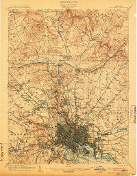
~ Baltimore MD topo map, 1:62500 scale, 15 X 15 Minute, Historical, 1904
Baltimore, Maryland, USGS topographic map dated 1904.
Includes geographic coordinates (latitude and longitude). This topographic map is suitable for hiking, camping, and exploring, or framing it as a wall map.
Printed on-demand using high resolution imagery, on heavy weight and acid free paper, or alternatively on a variety of synthetic materials.
Topos available on paper, Waterproof, Poly, or Tyvek. Usually shipping rolled, unless combined with other folded maps in one order.
- Product Number: USGS-5367932
- Free digital map download (high-resolution, GeoPDF): Baltimore, Maryland (file size: 11 MB)
- Map Size: please refer to the dimensions of the GeoPDF map above
- Weight (paper map): ca. 55 grams
- Map Type: POD USGS Topographic Map
- Map Series: HTMC
- Map Verison: Historical
- Cell ID: 50921
- Scan ID: 257287
- Survey Year: 1902
- Datum: Unstated
- Map Projection: Unstated
- Map published by United States Geological Survey
- Map Language: English
- Scanner Resolution: 600 dpi
- Map Cell Name: Baltimore
- Grid size: 15 X 15 Minute
- Date on map: 1904
- Map Scale: 1:62500
- Geographical region: Maryland, United States
Neighboring Maps:
All neighboring USGS topo maps are available for sale online at a variety of scales.
Spatial coverage:
Topo map Baltimore, Maryland, covers the geographical area associated the following places:
- Rockland - Catonsville Manor - Ranchleigh - Town and Country North - Bare Hills - Donnybrook - Bonnie Ridge - West Glen - Hampton East - Cylburn (historical) - Howard Park - Rogers (historical) - Worthington Club Estates - Campus Hills - Valley North - Rosedale Terrace - Highlandtown - The Terraces - Waterspout - Springlake - Brookview Farms - Claremont (historical) - Dundalk Mobile Home Court - Villa Cresta - Baynesville - Blenheim Manor - Morgan Park - West Hills - Blenheim - Cranwood - Grey Rock - Hampton Village - Velvet Ridge - Glenside Park - Falls Gable - Charles Village - Knettishall - Greenbrier - Sturbridge - Garden Village Park - Homestead - Riverview (historical) - Loch Raven - Rockland Run - Ramblewood - Sudbrook Park - Hampton Gardens - Brookwood - Morrell Park - North Bend - Wetheredsville - Shawan - Colgate Creek - Thornleigh - Autumn Wind - Oakleigh - Hillsdale Green - Anton North - Mount Vernon - Fishtown - Eccleston Valley - Greentop Manor - Wilhelm Park - Oak Forest Park - Valley Crest - Cockeysville - Colonial Park - Hillendale Park - Hillside at Seminary - Woodmoor - Bosley (historical) - Weyburn Park - Wellwood - Lake - The Beechs - Bluegrass Heights - Garrison Farms - Ten Hills - The Oaks at Five Farms - Montebello Park - Parkside Heights - Timberline Park - The Hill Farm - Kenwood - Parktowne - Meadowcliff - Minersville (historical) - Loch Hill - Greenspring - Oak Forest - Hunters Hill - Belmar - Towson - Village of Cross Keys - Timonium Heights - Holland Hills - Deer Woods - Williamsburg - Leahigh - Summer Hill
- Map Area ID: AREA39.539.25-76.75-76.5
- Northwest corner Lat/Long code: USGSNW39.5-76.75
- Northeast corner Lat/Long code: USGSNE39.5-76.5
- Southwest corner Lat/Long code: USGSSW39.25-76.75
- Southeast corner Lat/Long code: USGSSE39.25-76.5
- Northern map edge Latitude: 39.5
- Southern map edge Latitude: 39.25
- Western map edge Longitude: -76.75
- Eastern map edge Longitude: -76.5


