
~ Williamsport MD topo map, 1:24000 scale, 7.5 X 7.5 Minute, Historical, 1997, updated 2000
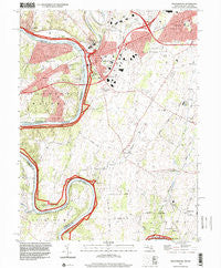
Williamsport, Maryland, USGS topographic map dated 1997.
Includes geographic coordinates (latitude and longitude). This topographic map is suitable for hiking, camping, and exploring, or framing it as a wall map.
Printed on-demand using high resolution imagery, on heavy weight and acid free paper, or alternatively on a variety of synthetic materials.
Topos available on paper, Waterproof, Poly, or Tyvek. Usually shipping rolled, unless combined with other folded maps in one order.
- Product Number: USGS-5367542
- Free digital map download (high-resolution, GeoPDF): Williamsport, Maryland (file size: 13 MB)
- Map Size: please refer to the dimensions of the GeoPDF map above
- Weight (paper map): ca. 55 grams
- Map Type: POD USGS Topographic Map
- Map Series: HTMC
- Map Verison: Historical
- Cell ID: 49183
- Scan ID: 257020
- Imprint Year: 2000
- Woodland Tint: Yes
- Aerial Photo Year: 1997
- Datum: NAD83
- Map Projection: Universal Transverse Mercator
- Map published by United States Geological Survey
- Map Language: English
- Scanner Resolution: 600 dpi
- Map Cell Name: Williamsport
- Grid size: 7.5 X 7.5 Minute
- Date on map: 1997
- Map Scale: 1:24000
- Geographical region: Maryland, United States
Neighboring Maps:
All neighboring USGS topo maps are available for sale online at a variety of scales.
Spatial coverage:
Topo map Williamsport, Maryland, covers the geographical area associated the following places:
- Downsville - Oak Ridge - Washington Four - Woburn Estates - Opequon Farms - Heritage Estates - Saint James - Conococheaque - Grimes - Potomac Woodlands - Mount Moriah - Halfway Manor - Kemps - Friendship Park - Van Lear Manor - Halfway - Marlowe - Bakersville - Tammany Manor - Woodmoor - Cedar Grove - Woodburn on the Potomac - Dogtown - Cloverton - Williamsport - Fairplay Farms - Spielman - Lake Fairplay Estates - Pleasant View Estates
- Map Area ID: AREA39.62539.5-77.875-77.75
- Northwest corner Lat/Long code: USGSNW39.625-77.875
- Northeast corner Lat/Long code: USGSNE39.625-77.75
- Southwest corner Lat/Long code: USGSSW39.5-77.875
- Southeast corner Lat/Long code: USGSSE39.5-77.75
- Northern map edge Latitude: 39.625
- Southern map edge Latitude: 39.5
- Western map edge Longitude: -77.875
- Eastern map edge Longitude: -77.75


