
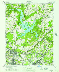
~ Towson MD topo map, 1:24000 scale, 7.5 X 7.5 Minute, Historical, 1944, updated 1957
Towson, Maryland, USGS topographic map dated 1944.
Includes geographic coordinates (latitude and longitude). This topographic map is suitable for hiking, camping, and exploring, or framing it as a wall map.
Printed on-demand using high resolution imagery, on heavy weight and acid free paper, or alternatively on a variety of synthetic materials.
Topos available on paper, Waterproof, Poly, or Tyvek. Usually shipping rolled, unless combined with other folded maps in one order.
- Product Number: USGS-5367410
- Free digital map download (high-resolution, GeoPDF): Towson, Maryland (file size: 13 MB)
- Map Size: please refer to the dimensions of the GeoPDF map above
- Weight (paper map): ca. 55 grams
- Map Type: POD USGS Topographic Map
- Map Series: HTMC
- Map Verison: Historical
- Cell ID: 71868
- Scan ID: 256941
- Imprint Year: 1957
- Woodland Tint: Yes
- Aerial Photo Year: 1943
- Datum: NAD27
- Map Projection: Polyconic
- Map published by United States Army Corps of Engineers
- Map published by United States Department of War
- Map Language: English
- Scanner Resolution: 600 dpi
- Map Cell Name: Towson
- Grid size: 7.5 X 7.5 Minute
- Date on map: 1944
- Map Scale: 1:24000
- Geographical region: Maryland, United States
Neighboring Maps:
All neighboring USGS topo maps are available for sale online at a variety of scales.
Spatial coverage:
Topo map Towson, Maryland, covers the geographical area associated the following places:
- Glendale - The Lakes - Woodcroft - Ridgeleigh - Summer Hill - Carroll Manor - Ridge Grove - Dulaney Village - Providence - Rodgers Forge - Anneslie - Halifax Heights - Britinay Hills - Manor Springs - Cub Hills - Yorkleigh - Stoneleigh - Armagh - Windemere - Manor Hill - Greenbrier - Dogwood Hills - Knollwood - Chestnut Hill - Cromwell Station - Oak Summit - Valley North - Blenheim Manor - Shetland Hills - Glenmont - Long Green - Knettishall - Northwind Village - Village of Vanderway - Pineleigh - Hillendale - Springlake - North Wind - Villa Cresta - Harford Farms - Satyr Hill Estates - Manor Woods - Cub Hill - The Cloisters at Charles - Revere Park - Dulaney Hills - Putty Hill - Havenwood - Lowell Ridge - Pot Spring - Summerfield (historical) - Valley View - Carney Grove - Yorktown - Marlywood - Stratford - Riderwood Hills - North Wind Farms - Ravenhurst - Towson - Baynesville - Towson Park - Hunters Hill - Bridlewood - Town and Country North - Warren - Northampton - Parkville - Evergreen - Lakeside - Pennbrook - Valewood at Hampton Gardens - Hampton Gardens - Valley Crest - Hillendale Farms - Loch Raven Heights - Bosley (historical) - Meadowcliff - Sheppard (historical) - Hampton Village - Goucher Woods - Towson Estates - The Beechs - Cambria - Deer Woods - Apple Ridge - Carney - Fellowship Forest - Loch Raven - Dulaney Gate - Summerfield Farms - Devonshire Forest - Idlewylde - Coventry - Cromwood - Parkville Heights - Wiltondale - Harford Hills - Huntcrest Estates - Manor Oaks
- Map Area ID: AREA39.539.375-76.625-76.5
- Northwest corner Lat/Long code: USGSNW39.5-76.625
- Northeast corner Lat/Long code: USGSNE39.5-76.5
- Southwest corner Lat/Long code: USGSSW39.375-76.625
- Southeast corner Lat/Long code: USGSSE39.375-76.5
- Northern map edge Latitude: 39.5
- Southern map edge Latitude: 39.375
- Western map edge Longitude: -76.625
- Eastern map edge Longitude: -76.5


