
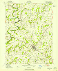
~ Taneytown MD topo map, 1:24000 scale, 7.5 X 7.5 Minute, Historical, 1953, updated 1955
Taneytown, Maryland, USGS topographic map dated 1953.
Includes geographic coordinates (latitude and longitude). This topographic map is suitable for hiking, camping, and exploring, or framing it as a wall map.
Printed on-demand using high resolution imagery, on heavy weight and acid free paper, or alternatively on a variety of synthetic materials.
Topos available on paper, Waterproof, Poly, or Tyvek. Usually shipping rolled, unless combined with other folded maps in one order.
- Product Number: USGS-5367372
- Free digital map download (high-resolution, GeoPDF): Taneytown, Maryland (file size: 10 MB)
- Map Size: please refer to the dimensions of the GeoPDF map above
- Weight (paper map): ca. 55 grams
- Map Type: POD USGS Topographic Map
- Map Series: HTMC
- Map Verison: Historical
- Cell ID: 44273
- Scan ID: 256922
- Imprint Year: 1955
- Woodland Tint: Yes
- Aerial Photo Year: 1942
- Datum: NAD27
- Map Projection: Polyconic
- Map published by United States Army Corps of Engineers
- Map Language: English
- Scanner Resolution: 600 dpi
- Map Cell Name: Taneytown
- Grid size: 7.5 X 7.5 Minute
- Date on map: 1953
- Map Scale: 1:24000
- Geographical region: Maryland, United States
Neighboring Maps:
All neighboring USGS topo maps are available for sale online at a variety of scales.
Spatial coverage:
Topo map Taneytown, Maryland, covers the geographical area associated the following places:
- Herring Estates - Stumptown - Mairs Mill - Wheatfields - Cloverberry - Greenland Manor - Ottersdale - Fairground Village - Brownsville - Eleven Meadows - Longs Mountain View - Walnut Grove - Longville - Hyser Estates - White Birch Estates - Brown Heights - Copperville - Rising Sun - Meadow Brook - Green Meadows - Palmer (historical) - Galt - Trevanion Terrace - Harney - Bridgeport - Ruthed Estates - Cunningham Acres - Copperfield - Roberts Mill Run - Crabster (historical) - Taneytown - Tranquility Estates - Stonemyer Manor
- Map Area ID: AREA39.7539.625-77.25-77.125
- Northwest corner Lat/Long code: USGSNW39.75-77.25
- Northeast corner Lat/Long code: USGSNE39.75-77.125
- Southwest corner Lat/Long code: USGSSW39.625-77.25
- Southeast corner Lat/Long code: USGSSE39.625-77.125
- Northern map edge Latitude: 39.75
- Southern map edge Latitude: 39.625
- Western map edge Longitude: -77.25
- Eastern map edge Longitude: -77.125


