
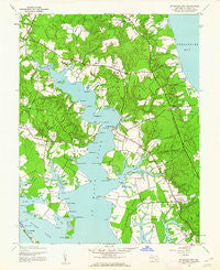
~ St Marys City MD topo map, 1:24000 scale, 7.5 X 7.5 Minute, Historical, 1943, updated 1962
St Marys City, Maryland, USGS topographic map dated 1943.
Includes geographic coordinates (latitude and longitude). This topographic map is suitable for hiking, camping, and exploring, or framing it as a wall map.
Printed on-demand using high resolution imagery, on heavy weight and acid free paper, or alternatively on a variety of synthetic materials.
Topos available on paper, Waterproof, Poly, or Tyvek. Usually shipping rolled, unless combined with other folded maps in one order.
- Product Number: USGS-5367322
- Free digital map download (high-resolution, GeoPDF): St Marys City, Maryland (file size: 10 MB)
- Map Size: please refer to the dimensions of the GeoPDF map above
- Weight (paper map): ca. 55 grams
- Map Type: POD USGS Topographic Map
- Map Series: HTMC
- Map Verison: Historical
- Cell ID: 39354
- Scan ID: 256897
- Imprint Year: 1962
- Woodland Tint: Yes
- Aerial Photo Year: 1942
- Survey Year: 1943
- Datum: NAD27
- Map Projection: Polyconic
- Map published by United States Geological Survey
- Map Language: English
- Scanner Resolution: 600 dpi
- Map Cell Name: Saint Marys City
- Grid size: 7.5 X 7.5 Minute
- Date on map: 1943
- Map Scale: 1:24000
- Geographical region: Maryland, United States
Neighboring Maps:
All neighboring USGS topo maps are available for sale online at a variety of scales.
Spatial coverage:
Topo map St Marys City, Maryland, covers the geographical area associated the following places:
- Leachburg - Hills Trailer Park - Flowers of the Forest - Saint Marys River Estates - Willow Brook Estates - Dutchmans Cove - Gum Landing - Saint Peters Key - Saint James - West Saint Marys - Ancient Oaks - Lord Calvert Mobile Home Park - Sunrise Acres - Evergreen Park - Bluestone Estates - Carthagena Creek - Park Pines - Benedict Smiths - Park Hall Estates - Spring Ridge - Saint Marys City - Upper Jutland - Delle Bourne - Great Mills - Beachville - Saint Inigoes Shores - Bates Acres - Portobello - Stoney Run - Calloway Landing - Rosecroft - Hunting Neck Woods - Greens Rest Manor - Drayden - Cedar Landing - Hermanville - Laurel Run
- Map Area ID: AREA38.2538.125-76.5-76.375
- Northwest corner Lat/Long code: USGSNW38.25-76.5
- Northeast corner Lat/Long code: USGSNE38.25-76.375
- Southwest corner Lat/Long code: USGSSW38.125-76.5
- Southeast corner Lat/Long code: USGSSE38.125-76.375
- Northern map edge Latitude: 38.25
- Southern map edge Latitude: 38.125
- Western map edge Longitude: -76.5
- Eastern map edge Longitude: -76.375


