
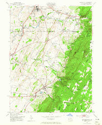
~ Smithsburg MD topo map, 1:24000 scale, 7.5 X 7.5 Minute, Historical, 1953, updated 1965
Smithsburg, Maryland, USGS topographic map dated 1953.
Includes geographic coordinates (latitude and longitude). This topographic map is suitable for hiking, camping, and exploring, or framing it as a wall map.
Printed on-demand using high resolution imagery, on heavy weight and acid free paper, or alternatively on a variety of synthetic materials.
Topos available on paper, Waterproof, Poly, or Tyvek. Usually shipping rolled, unless combined with other folded maps in one order.
- Product Number: USGS-5367248
- Free digital map download (high-resolution, GeoPDF): Smithsburg, Maryland (file size: 13 MB)
- Map Size: please refer to the dimensions of the GeoPDF map above
- Weight (paper map): ca. 55 grams
- Map Type: POD USGS Topographic Map
- Map Series: HTMC
- Map Verison: Historical
- Cell ID: 41807
- Scan ID: 256855
- Imprint Year: 1965
- Woodland Tint: Yes
- Aerial Photo Year: 1943
- Field Check Year: 1944
- Datum: NAD27
- Map Projection: Polyconic
- Map published by United States Army Corps of Engineers
- Map Language: English
- Scanner Resolution: 600 dpi
- Map Cell Name: Smithsburg
- Grid size: 7.5 X 7.5 Minute
- Date on map: 1953
- Map Scale: 1:24000
- Geographical region: Maryland, United States
Neighboring Maps:
All neighboring USGS topo maps are available for sale online at a variety of scales.
Spatial coverage:
Topo map Smithsburg, Maryland, covers the geographical area associated the following places:
- Beaverbrook - Greenvale Village - Wayne Heights - Cavetown - Bluegrass Estates - Orchard Estates - Eastland Hills - Edgemont - Hill Village - Blue Mountain - Shockeys (historical) - Havenwood Hills - Buena Vista Springs - Country Squire Estates - Leitersburg - Rocky Forge - Holiday Acres - Holiday Farms - Cress - Smithsburg - Waterloo - Ringgold - Beartown - Rouzerville - Pen Mar - Greensburg - Pleasant Valley - Midvale - Hopkins Ridge - Blueberry Heights - Pen Mar Park - Bowmans Mill
- Map Area ID: AREA39.7539.625-77.625-77.5
- Northwest corner Lat/Long code: USGSNW39.75-77.625
- Northeast corner Lat/Long code: USGSNE39.75-77.5
- Southwest corner Lat/Long code: USGSSW39.625-77.625
- Southeast corner Lat/Long code: USGSSE39.625-77.5
- Northern map edge Latitude: 39.75
- Southern map edge Latitude: 39.625
- Western map edge Longitude: -77.625
- Eastern map edge Longitude: -77.5


