
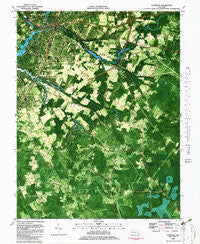
~ Salisbury MD topo map, 1:24000 scale, 7.5 X 7.5 Minute, Historical, 1982, updated 1983
Salisbury, Maryland, USGS topographic map dated 1982.
Includes geographic coordinates (latitude and longitude). This topographic map is suitable for hiking, camping, and exploring, or framing it as a wall map.
Printed on-demand using high resolution imagery, on heavy weight and acid free paper, or alternatively on a variety of synthetic materials.
Topos available on paper, Waterproof, Poly, or Tyvek. Usually shipping rolled, unless combined with other folded maps in one order.
- Product Number: USGS-5367180
- Free digital map download (high-resolution, GeoPDF): Salisbury, Maryland (file size: 20 MB)
- Map Size: please refer to the dimensions of the GeoPDF map above
- Weight (paper map): ca. 55 grams
- Map Type: POD USGS Topographic Map
- Map Series: HTMC
- Map Verison: Historical
- Cell ID: 39468
- Scan ID: 256819
- Imprint Year: 1983
- Woodland Tint: Yes
- Aerial Photo Year: 1978
- Edit Year: 1982
- Field Check Year: 1975
- Datum: NAD27
- Map Projection: Lambert Conformal Conic
- Orthophoto: Map
- Map published by United States Geological Survey
- Map Language: English
- Scanner Resolution: 600 dpi
- Map Cell Name: Salisbury
- Grid size: 7.5 X 7.5 Minute
- Date on map: 1982
- Map Scale: 1:24000
- Geographical region: Maryland, United States
Neighboring Maps:
All neighboring USGS topo maps are available for sale online at a variety of scales.
Spatial coverage:
Topo map Salisbury, Maryland, covers the geographical area associated the following places:
- Chelsea Court - Highland Park - John Walstons Mobile Home Park - Druid Hill Park - Park Manor - Mount Hermon - Hunting Park - Autumn Grove - Carey Heights - Green Forest Estates - Sunayr - Canton - Fruitland - Waycroft - Foggy Bottom - Oakland Acres - Rustic Acres - Philmore Park - Linda Manor - Jersey - Hollywood - Minksville (historical) - Riverside Homes - Doe Run - Belmont - Pecan Acres - Mount Hermon Heights - Woodfield - Covered Bridge Estates - Trace Hollow - Quail Ridge - Colbourn Manor - Windham Manor - Deep Harbour - California - Longridge - Heritage Manor - Moores Corner - Camden - Mount Olive Manor - Kaywood - Dogwood Village - White Plains - Riverside Pines - Pheasant Run - Perrys Haven - Summit - Hotton Acres - Nevins Mill - Midvale Manor - Fairfield - Coulborn Mill Valley - Frankford (historical) - Nevins Addition - North Kaywood - Brookshire Knolls - Eastview Park - Kilbirnie Estates - Washington Heights - Lakewood - Magnolia Terrace - Brafferton - Crestwood - Suburban Acres - Moonglow Manor - Salisbury - Livingston Heights - Lincoln Heights - Morris Mill - Foxchase
- Map Area ID: AREA38.37538.25-75.625-75.5
- Northwest corner Lat/Long code: USGSNW38.375-75.625
- Northeast corner Lat/Long code: USGSNE38.375-75.5
- Southwest corner Lat/Long code: USGSSW38.25-75.625
- Southeast corner Lat/Long code: USGSSE38.25-75.5
- Northern map edge Latitude: 38.375
- Southern map edge Latitude: 38.25
- Western map edge Longitude: -75.625
- Eastern map edge Longitude: -75.5


