
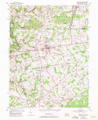
~ Rising Sun MD topo map, 1:24000 scale, 7.5 X 7.5 Minute, Historical, 1953, updated 1971
Rising Sun, Maryland, USGS topographic map dated 1953.
Includes geographic coordinates (latitude and longitude). This topographic map is suitable for hiking, camping, and exploring, or framing it as a wall map.
Printed on-demand using high resolution imagery, on heavy weight and acid free paper, or alternatively on a variety of synthetic materials.
Topos available on paper, Waterproof, Poly, or Tyvek. Usually shipping rolled, unless combined with other folded maps in one order.
- Product Number: USGS-5367130
- Free digital map download (high-resolution, GeoPDF): Rising Sun, Maryland (file size: 11 MB)
- Map Size: please refer to the dimensions of the GeoPDF map above
- Weight (paper map): ca. 55 grams
- Map Type: POD USGS Topographic Map
- Map Series: HTMC
- Map Verison: Historical
- Cell ID: 38011
- Scan ID: 256790
- Imprint Year: 1971
- Woodland Tint: Yes
- Photo Revision Year: 1970
- Aerial Photo Year: 1970
- Edit Year: 1953
- Survey Year: 1940
- Datum: NAD27
- Map Projection: Polyconic
- Map published by United States Geological Survey
- Map Language: English
- Scanner Resolution: 600 dpi
- Map Cell Name: Rising Sun
- Grid size: 7.5 X 7.5 Minute
- Date on map: 1953
- Map Scale: 1:24000
- Geographical region: Maryland, United States
Neighboring Maps:
All neighboring USGS topo maps are available for sale online at a variety of scales.
Spatial coverage:
Topo map Rising Sun, Maryland, covers the geographical area associated the following places:
- Oak Grove - Honeysuckle Hollow - Proctors Seat - Nottingham Fields - Freemont - Orchard View - Greenhurst - Holland Acres - Lees Mill - Maple Hill Mobile Home Park - West Nottingham - Chelsea of Nottingham - Colora - Liberty Grove - Woodlyn Heights - Greenfield Acres - Colony Acres - Woodlawn - Mason Dixon Village - Highlands - Running Brook Mobile Home Park - Frank - Woodlawn Mobile Home Estates - Theodore - Mount Pleasant View - Country Acres - Sunset Gardens - North Hills - Principio Heights - Mount Pleasant Acres - Vinegar Hill - Sunrise Estates - Port Heights - Curtis Acres - Sylmar - Mount Pleasant Manor - Waibelwood Park - Tome Estates - Sunview - Wooldlawn Heights - Cathers Corner - Jackson Mill Farms - Winchester Village - Spring Meadow - Barnes Corner - Hopewell Manor - Harrisville - Octararo (historical) - Nottingham - Timber Grove Mobile Home Park - Sylmar - Sunset Knoll - Principio - Farmington - Octararo Lakes - Hillview Farms - Sweet Grass Meadow - Rising Sun - Clearview - Pleasant View
- Map Area ID: AREA39.7539.625-76.125-76
- Northwest corner Lat/Long code: USGSNW39.75-76.125
- Northeast corner Lat/Long code: USGSNE39.75-76
- Southwest corner Lat/Long code: USGSSW39.625-76.125
- Southeast corner Lat/Long code: USGSSE39.625-76
- Northern map edge Latitude: 39.75
- Southern map edge Latitude: 39.625
- Western map edge Longitude: -76.125
- Eastern map edge Longitude: -76


