
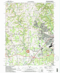
~ Newark West DE topo map, 1:24000 scale, 7.5 X 7.5 Minute, Historical, 1992, updated 1993
Newark West, Delaware, USGS topographic map dated 1992.
Includes geographic coordinates (latitude and longitude). This topographic map is suitable for hiking, camping, and exploring, or framing it as a wall map.
Printed on-demand using high resolution imagery, on heavy weight and acid free paper, or alternatively on a variety of synthetic materials.
Topos available on paper, Waterproof, Poly, or Tyvek. Usually shipping rolled, unless combined with other folded maps in one order.
- Product Number: USGS-5366856
- Free digital map download (high-resolution, GeoPDF): Newark West, Delaware (file size: 16 MB)
- Map Size: please refer to the dimensions of the GeoPDF map above
- Weight (paper map): ca. 55 grams
- Map Type: POD USGS Topographic Map
- Map Series: HTMC
- Map Verison: Historical
- Cell ID: 31903
- Scan ID: 256646
- Imprint Year: 1993
- Woodland Tint: Yes
- Visual Version Number: 2
- Aerial Photo Year: 1989
- Edit Year: 1992
- Field Check Year: 1991
- Datum: NAD83
- Map Projection: Universal Transverse Mercator
- Map published by United States Geological Survey
- Map Language: English
- Scanner Resolution: 600 dpi
- Map Cell Name: Newark West
- Grid size: 7.5 X 7.5 Minute
- Date on map: 1992
- Map Scale: 1:24000
- Geographical region: Delaware, United States
Neighboring Maps:
All neighboring USGS topo maps are available for sale online at a variety of scales.
Spatial coverage:
Topo map Newark West, Delaware, covers the geographical area associated the following places:
- Mechanicsville - Greenridge - Oaktree Apartments - Manchester Park - Cottage Mill - Hidden Acres - Northminster at Fair Hill - The Meadows at Elk Creek - Newark - Glen Kyle - Barksdale - Devon - Fairfield - Chippendale - Nonatum Mills - West Creek Village - Bank (historical) - Four Seasons - Thompson - Oakland - Silver Brook - Foxchase Manor - Molitor Estates - Bel Hill (historical) - Childs - Hunting Hills - McClellandville - El Paco Farms - Brewster Heights - Cristine Manor - Grand Meadows - Wedge Hills - Appleton Glen - Kenmore - Cecil Manor - Kemblesville - Colonial Acres - Fair Hill - Meadowview Park - Glen Farms - Elk Mills - Thabar - Boot Hill - Top of the Wedge - Cowentown - Winding Brook Village - Amaranth - Fairfield Crest - Singerly - Hillcrest - Everbreeze - Iron Hill - College Park - Covered Bridge Farms - Foxcatcher at Fair Hill - Glen Westover - Palm Springs Manor - Bristle Knoll - Franklin - Gilpin Farms - The Highlands - Academy Hills - Foxfield - Cherry Hill - Nottingham Manor - Wedgewood Hills - Arbour Park - Iron Hill - Lewisville - Strickersville - Tara - Winchester - Oakridge - Cherry Wood - Summit View - Appleton Acres - Andora - Surrey Ridge - Christina Manor - Nottingham Green - Appleton - Meadowview - Springlawn - Cherry Hill - Barksdale Farms - Andora Acres
- Map Area ID: AREA39.7539.625-75.875-75.75
- Northwest corner Lat/Long code: USGSNW39.75-75.875
- Northeast corner Lat/Long code: USGSNE39.75-75.75
- Southwest corner Lat/Long code: USGSSW39.625-75.875
- Southeast corner Lat/Long code: USGSSE39.625-75.75
- Northern map edge Latitude: 39.75
- Southern map edge Latitude: 39.625
- Western map edge Longitude: -75.875
- Eastern map edge Longitude: -75.75


