
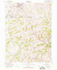
~ Littlestown PA topo map, 1:24000 scale, 7.5 X 7.5 Minute, Historical, 1953, updated 1969
Littlestown, Pennsylvania, USGS topographic map dated 1953.
Includes geographic coordinates (latitude and longitude). This topographic map is suitable for hiking, camping, and exploring, or framing it as a wall map.
Printed on-demand using high resolution imagery, on heavy weight and acid free paper, or alternatively on a variety of synthetic materials.
Topos available on paper, Waterproof, Poly, or Tyvek. Usually shipping rolled, unless combined with other folded maps in one order.
- Product Number: USGS-5366656
- Free digital map download (high-resolution, GeoPDF): Littlestown, Pennsylvania (file size: 11 MB)
- Map Size: please refer to the dimensions of the GeoPDF map above
- Weight (paper map): ca. 55 grams
- Map Type: POD USGS Topographic Map
- Map Series: HTMC
- Map Verison: Historical
- Cell ID: 26095
- Scan ID: 256540
- Imprint Year: 1969
- Woodland Tint: Yes
- Aerial Photo Year: 1943
- Field Check Year: 1944
- Datum: NAD27
- Map Projection: Polyconic
- Map published by United States Army Corps of Engineers
- Map Language: English
- Scanner Resolution: 600 dpi
- Map Cell Name: Littlestown
- Grid size: 7.5 X 7.5 Minute
- Date on map: 1953
- Map Scale: 1:24000
- Geographical region: Pennsylvania, United States
Neighboring Maps:
All neighboring USGS topo maps are available for sale online at a variety of scales.
Spatial coverage:
Topo map Littlestown, Pennsylvania, covers the geographical area associated the following places:
- Menges Mill - Richardson Ridge - Hidden Oaks - Bear Run - Arters Mill Estates - Mount Pleasant - Silver Run Estates - Piney Creek (historical) - Larox Miracle Land - Pipe Creek Mill - Littlestown - Cherrytown - Hoot'N Hollow - Locust Neck Heights - Twin Lakes - Georgetown - Union Mills - Oak Grove - Silver Hills - Arters Mill - Breezewood Estates - Slate Ridge - Mayberry - Blacks Corner - Liebno Estates - Shoemakers Lot - Babylon Heights - Wolfs Mill - Linden Estates - Cambridge Estates - Pleasant Valley - Silver Run - Humbert Schoolhouse Estates - Hahns Mill - Allandale - Mount Pleasant - Kingsdale - Huckleberry Bottom - Colonial Hills - Runnymeade Summit - Greenfield - Mayberry Ridge - Shour Valley - Little Acres
- Map Area ID: AREA39.7539.625-77.125-77
- Northwest corner Lat/Long code: USGSNW39.75-77.125
- Northeast corner Lat/Long code: USGSNE39.75-77
- Southwest corner Lat/Long code: USGSSW39.625-77.125
- Southeast corner Lat/Long code: USGSSE39.625-77
- Northern map edge Latitude: 39.75
- Southern map edge Latitude: 39.625
- Western map edge Longitude: -77.125
- Eastern map edge Longitude: -77


