
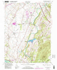
~ Buckeystown MD topo map, 1:24000 scale, 7.5 X 7.5 Minute, Historical, 1952, updated 1986
Buckeystown, Maryland, USGS topographic map dated 1952.
Includes geographic coordinates (latitude and longitude). This topographic map is suitable for hiking, camping, and exploring, or framing it as a wall map.
Printed on-demand using high resolution imagery, on heavy weight and acid free paper, or alternatively on a variety of synthetic materials.
Topos available on paper, Waterproof, Poly, or Tyvek. Usually shipping rolled, unless combined with other folded maps in one order.
- Product Number: USGS-5365874
- Free digital map download (high-resolution, GeoPDF): Buckeystown, Maryland (file size: 12 MB)
- Map Size: please refer to the dimensions of the GeoPDF map above
- Weight (paper map): ca. 55 grams
- Map Type: POD USGS Topographic Map
- Map Series: HTMC
- Map Verison: Historical
- Cell ID: 5912
- Scan ID: 256121
- Imprint Year: 1986
- Woodland Tint: Yes
- Visual Version Number: 2
- Photo Revision Year: 1984
- Aerial Photo Year: 1943
- Edit Year: 1952
- Datum: NAD27
- Map Projection: Polyconic
- Map published by United States Army Corps of Engineers
- Map Language: English
- Scanner Resolution: 600 dpi
- Map Cell Name: Buckeystown
- Grid size: 7.5 X 7.5 Minute
- Date on map: 1952
- Map Scale: 1:24000
- Geographical region: Maryland, United States
Neighboring Maps:
All neighboring USGS topo maps are available for sale online at a variety of scales.
Spatial coverage:
Topo map Buckeystown, Maryland, covers the geographical area associated the following places:
- Flint Hill - Country Side - Amelung Estates - Manor Village - Mowry - Mountville Manor - Mulberry Tree Acres - Windsor Estates - Stonewall Manor Estates - Monocacy Overlook - Buckeystown - Paulson - South Covell - Park Mills - Church Hill - Sugarloaf West - Michaels Mill - Robin Meadows - Hope Valley Hills - Sugarloaf Estates - Greenfield Mills - Greenfield Acres - Buckeystown Station - Lilypons - Titus Estates - New Design Acres - Hope Hill - Pleasant View - Keller - Kidwiler Park - Adamstown - Frederick Junction - Matovich - Ballenger Heights - Poplar Thicket - Tuscarora - Ballenger Creek - West Frederick Highlands - Lime Kiln - Buckingham Hills - Doubs - Stronghold - Renn Branch Estates - Araby View
- Map Area ID: AREA39.37539.25-77.5-77.375
- Northwest corner Lat/Long code: USGSNW39.375-77.5
- Northeast corner Lat/Long code: USGSNE39.375-77.375
- Southwest corner Lat/Long code: USGSSW39.25-77.5
- Southeast corner Lat/Long code: USGSSE39.25-77.375
- Northern map edge Latitude: 39.375
- Southern map edge Latitude: 39.25
- Western map edge Longitude: -77.5
- Eastern map edge Longitude: -77.375


