
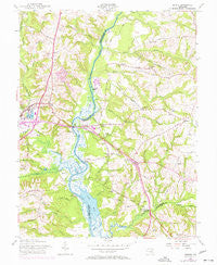
~ Bristol MD topo map, 1:24000 scale, 7.5 X 7.5 Minute, Historical, 1957
Bristol, Maryland, USGS topographic map dated 1957.
Includes geographic coordinates (latitude and longitude). This topographic map is suitable for hiking, camping, and exploring, or framing it as a wall map.
Printed on-demand using high resolution imagery, on heavy weight and acid free paper, or alternatively on a variety of synthetic materials.
Topos available on paper, Waterproof, Poly, or Tyvek. Usually shipping rolled, unless combined with other folded maps in one order.
- Product Number: USGS-5365852
- Free digital map download (high-resolution, GeoPDF): Bristol, Maryland (file size: 11 MB)
- Map Size: please refer to the dimensions of the GeoPDF map above
- Weight (paper map): ca. 55 grams
- Map Type: POD USGS Topographic Map
- Map Series: HTMC
- Map Verison: Historical
- Cell ID: 5503
- Scan ID: 256110
- Woodland Tint: Yes
- Photo Revision Year: 1970
- Aerial Photo Year: 1970
- Survey Year: 1944
- Datum: NAD27
- Map Projection: Polyconic
- Map published by United States Army Corps of Engineers
- Map Language: English
- Scanner Resolution: 600 dpi
- Map Cell Name: Bristol
- Grid size: 7.5 X 7.5 Minute
- Date on map: 1957
- Map Scale: 1:24000
- Geographical region: Maryland, United States
Neighboring Maps:
All neighboring USGS topo maps are available for sale online at a variety of scales.
Spatial coverage:
Topo map Bristol, Maryland, covers the geographical area associated the following places:
- Springfield - Twin Shields Estates - Croom Acres - Conte Manor - Lothian Estates - Portland Manor - Upper Marlboro - Lothian Woods - Lyons Creek Hundred - Hawthorne Woods - Green Landing - Wells Corner - Boones Mobile Estates - Greenock - Jackson Landing - Waysons Mobile Court - Maryland Mobile Estates - Pindell - Century Manor - Bayard - Bristol Landing (historical) - Lahaina - Lyons Creek Mobile Estates - Darnall - Waysons Corner - Fox Chapel - Mount Calvert - Selbys Landing - Drury - Heritage Hills - Chaney Station - Rio Vista Plaza Mobile Home Park - Reo Vista Plaza - Marlboro Meadows - Leeland - Hunt Chapel - Pond View Acres - Bristol - Mary E White Estate - Courtney Manor - Rustic Knolls - Dunleigh - Patuxent Mobile Estates - Pig Point - Calvert Estates - Hunt Valley Estates - Winding Brooke - Boone's Mobile Estates - The Sands - Chaney
- Map Area ID: AREA38.87538.75-76.75-76.625
- Northwest corner Lat/Long code: USGSNW38.875-76.75
- Northeast corner Lat/Long code: USGSNE38.875-76.625
- Southwest corner Lat/Long code: USGSSW38.75-76.75
- Southeast corner Lat/Long code: USGSSE38.75-76.625
- Northern map edge Latitude: 38.875
- Southern map edge Latitude: 38.75
- Western map edge Longitude: -76.75
- Eastern map edge Longitude: -76.625


