
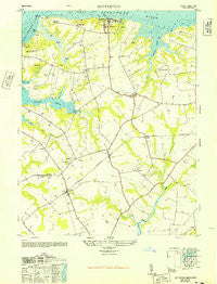
~ Betterton MD topo map, 1:24000 scale, 7.5 X 7.5 Minute, Historical, 1948
Betterton, Maryland, USGS topographic map dated 1948.
Includes geographic coordinates (latitude and longitude). This topographic map is suitable for hiking, camping, and exploring, or framing it as a wall map.
Printed on-demand using high resolution imagery, on heavy weight and acid free paper, or alternatively on a variety of synthetic materials.
Topos available on paper, Waterproof, Poly, or Tyvek. Usually shipping rolled, unless combined with other folded maps in one order.
- Product Number: USGS-5365784
- Free digital map download (high-resolution, GeoPDF): Betterton, Maryland (file size: 9 MB)
- Map Size: please refer to the dimensions of the GeoPDF map above
- Weight (paper map): ca. 55 grams
- Map Type: POD USGS Topographic Map
- Map Series: HTMC
- Map Verison: Historical
- Cell ID: 3558
- Scan ID: 256075
- Woodland Tint: Yes
- Aerial Photo Year: 1947
- Datum: NAD27
- Map Projection: Transverse Mercator
- Map published by United States Army
- Map Language: English
- Scanner Resolution: 600 dpi
- Map Cell Name: Betterton
- Grid size: 7.5 X 7.5 Minute
- Date on map: 1948
- Map Scale: 1:24000
- Geographical region: Maryland, United States
Neighboring Maps:
All neighboring USGS topo maps are available for sale online at a variety of scales.
Spatial coverage:
Topo map Betterton, Maryland, covers the geographical area associated the following places:
- Still Pond - Butlertown - Hepbron - Coleman - Bigwoods - Parson Hill - Lynch - Betterton - Worton - Robinson Corner - Runnymeade Estates - Kentfield - Urieville - Smithville - Echo Hill - Worton Manor Mobile Home Park - Morgnec - Goose Hill - Hassengers Corner - The Pines - Catts Corner
- Map Area ID: AREA39.37539.25-76.125-76
- Northwest corner Lat/Long code: USGSNW39.375-76.125
- Northeast corner Lat/Long code: USGSNE39.375-76
- Southwest corner Lat/Long code: USGSSW39.25-76.125
- Southeast corner Lat/Long code: USGSSE39.25-76
- Northern map edge Latitude: 39.375
- Southern map edge Latitude: 39.25
- Western map edge Longitude: -76.125
- Eastern map edge Longitude: -76


