
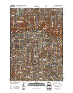
~ Derr Meadows OR topo map, 1:24000 scale, 7.5 X 7.5 Minute, Historical, 2011
Derr Meadows, Oregon, USGS topographic map dated 2011.
Includes geographic coordinates (latitude and longitude). This topographic map is suitable for hiking, camping, and exploring, or framing it as a wall map.
Printed on-demand using high resolution imagery, on heavy weight and acid free paper, or alternatively on a variety of synthetic materials.
Topos available on paper, Waterproof, Poly, or Tyvek. Usually shipping rolled, unless combined with other folded maps in one order.
- Product Number: USGS-5365486
- Free digital map download (high-resolution, GeoPDF): Derr Meadows, Oregon (file size: 25 MB)
- Map Size: please refer to the dimensions of the GeoPDF map above
- Weight (paper map): ca. 55 grams
- Map Type: POD USGS Topographic Map
- Map Series: US Topo
- Map Verison: Historical
- Cell ID: 12005
- Datum: North American Datum of 1983
- Map Projection: Transverse Mercator
- Map Cell Name: Derr Meadows
- Grid size: 7.5 X 7.5 Minute
- Date on map: 2011
- Map Scale: 1:24000
- Geographical region: Oregon, United States
Neighboring Maps:
All neighboring USGS topo maps are available for sale online at a variety of scales.
Spatial coverage:
Topo map Derr Meadows, Oregon, covers the geographical area associated the following places:
- Happy Jack Camp - Fry Spring - Sam Davis Spring - Younger Spring - Derr Meadows - Double Corral - Barnhouse Spring - Aspen Grove Spring - Chamberlin Spring - Camp Watson Cemetery - Camp Watson (historical) - Happy Camp Creek - Jackson Creek - Derr Camp - Derr Creek - Blevins Spring - Derr Guard Station - Double Corral Creek - Toggle Creek - Haypress Creek - Toggle Meadows - Barnhouse Recreation Site - Camp Watson Post Office (historical) - Camp Watson Point - Chambers Spring - Buck Point Troughs - Dicer Meadow - West Buker Spring - Cabbage Creek - Alder Spring - Buck Point
- Map Area ID: AREA44.544.375-120-119.875
- Northwest corner Lat/Long code: USGSNW44.5-120
- Northeast corner Lat/Long code: USGSNE44.5-119.875
- Southwest corner Lat/Long code: USGSSW44.375-120
- Southeast corner Lat/Long code: USGSSE44.375-119.875
- Northern map edge Latitude: 44.5
- Southern map edge Latitude: 44.375
- Western map edge Longitude: -120
- Eastern map edge Longitude: -119.875


