
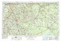
~ Waycross GA topo map, 1:250000 scale, 1 X 2 Degree, Historical, 1953, updated 1984
Waycross, Georgia, USGS topographic map dated 1953.
Includes geographic coordinates (latitude and longitude). This topographic map is suitable for hiking, camping, and exploring, or framing it as a wall map.
Printed on-demand using high resolution imagery, on heavy weight and acid free paper, or alternatively on a variety of synthetic materials.
Topos available on paper, Waterproof, Poly, or Tyvek. Usually shipping rolled, unless combined with other folded maps in one order.
- Product Number: USGS-5365408
- Free digital map download (high-resolution, GeoPDF): Waycross, Georgia (file size: 20 MB)
- Map Size: please refer to the dimensions of the GeoPDF map above
- Weight (paper map): ca. 55 grams
- Map Type: POD USGS Topographic Map
- Map Series: HTMC
- Map Verison: Historical
- Cell ID: 69091
- Scan ID: 247858
- Imprint Year: 1984
- Woodland Tint: Yes
- Aerial Photo Year: 1951
- Edit Year: 1966
- Field Check Year: 1953
- Datum: Unstated
- Map Projection: Transverse Mercator
- Map published by United States Geological Survey
- Map Language: English
- Scanner Resolution: 600 dpi
- Map Cell Name: Waycross
- Grid size: 1 X 2 Degree
- Date on map: 1953
- Map Scale: 1:250000
- Geographical region: Georgia, United States
Neighboring Maps:
All neighboring USGS topo maps are available for sale online at a variety of scales.
Spatial coverage:
Topo map Waycross, Georgia, covers the geographical area associated the following places:
- Pine Hill - Holt - Seville - Liberty Hill - Cedarpark - San Barnard (historical) - Alapaha - Gintown (historical) - Lotts - Hoganville (historical) - Tifton - Barbers - Riverside - High Springs (historical) - Coney - Staunton - Speer Homes - Armboy - Relee - Rhine - Brentwood - Eldorado - Bingham (historical) - Queensland - Barneyville - Schley - New Lois - Fitzgerald - Brooker - Maysie (historical) - Springhill - Lax - Coolidge - Omega - Three Points - Barney - Spring Branch - Aspinwall - Beach - Minnesota - Marshall - Ruskin - Cook Heights - Acree - Powelltown - Barretts - Ashton - Weatherly Park - Irwinville - Bolen - Murphy - Clay Homes - Massee - Guysie - Waltertown - Sibley - Five Points - Harding - Dixie Union - Ferry Lake - Mora - Felder (historical) - Pebblebrook - Lands Crossroads - Allenville - Wahoma - Bethel - Workmore - Ganor - Daphne (historical) - Acorn Pond - McTier - Arabi - Skullhead - Haywood - Douglas - Eightmile Still - Pridgen - Blue Spring (historical) - Gordy - Wenona - Bedgood - Crawley - Heartpine (historical) - Pine Valley - Westwood - Lulaville - Williford (historical) - Doles - Henderson Still - Warrick Homes - Cobbville - Gracys Station (historical) - Talmo - Zion - Sibbie - Statham Shoals - Paletree - Axson - Woodcrest Subdivision
- Map Area ID: AREA3231-84-82
- Northwest corner Lat/Long code: USGSNW32-84
- Northeast corner Lat/Long code: USGSNE32-82
- Southwest corner Lat/Long code: USGSSW31-84
- Southeast corner Lat/Long code: USGSSE31-82
- Northern map edge Latitude: 32
- Southern map edge Latitude: 31
- Western map edge Longitude: -84
- Eastern map edge Longitude: -82


