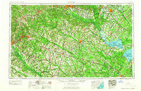
~ Augusta GA topo map, 1:250000 scale, 1 X 2 Degree, Historical, 1961
Augusta, Georgia, USGS topographic map dated 1961.
Includes geographic coordinates (latitude and longitude). This topographic map is suitable for hiking, camping, and exploring, or framing it as a wall map.
Printed on-demand using high resolution imagery, on heavy weight and acid free paper, or alternatively on a variety of synthetic materials.
Topos available on paper, Waterproof, Poly, or Tyvek. Usually shipping rolled, unless combined with other folded maps in one order.
- Product Number: USGS-5365344
- Free digital map download (high-resolution, GeoPDF): Augusta, Georgia (file size: 21 MB)
- Map Size: please refer to the dimensions of the GeoPDF map above
- Weight (paper map): ca. 55 grams
- Map Type: POD USGS Topographic Map
- Map Series: HTMC
- Map Verison: Historical
- Cell ID: 68654
- Scan ID: 247827
- Woodland Tint: Yes
- Aerial Photo Year: 1943
- Field Check Year: 1957
- Datum: Unstated
- Map Projection: Transverse Mercator
- Map published by United States Geological Survey
- Map Language: English
- Scanner Resolution: 600 dpi
- Map Cell Name: Augusta
- Grid size: 1 X 2 Degree
- Date on map: 1961
- Map Scale: 1:250000
- Geographical region: Georgia, United States
Neighboring Maps:
All neighboring USGS topo maps are available for sale online at a variety of scales.
Spatial coverage:
Topo map Augusta, Georgia, covers the geographical area associated the following places:
- Huets Crossroads - Bowman - Hilldale - Inabinetts (historical) - Strathaven Forest - Plunket (historical) - Shell Bluff Landing - Edgefield - Ulmer - Colonial Heights - Bendemeer - Hazelwood Acres - Country Club Estates - Harvin - Donora (historical) - Kings Grant - Hunter Hill - Elmwood Park - Lakeside Acres - Felderville - Millbrook Estates - Ivey Hall - Scotch Range Estates - Pine Hill - Avondale - Owens Crossroad - Sugar Hill - Twin Oaks - Lambrick - Bolen Town - Bahama Heights - Davis Station - Parkwood - Edenwood - Tramway - Cedarwood - General Sumter Estates - Home Acres - Crestdale - Pineview Estates - Jones Crossroads - Spring Plain (historical) - Fountain Lake - Cayce - Bouknight - Monticello Estates - Black Creek - Challendon - Hughes - Hudsontown - Green Town - Pinedale - Galaxy - Quinns Crossroad - Berkeley Forest - Healing Springs - Scottsville - North Brentwood - Murray - Smithfield - Congaree Gardens - Rosemary (historical) - Sandy Run - Chicora - Heathwood Park - Johnston - Westover - Deer Ridge Farms - Saint George - Melwood - Azalea Estates - Fairhill - Rowland - Legare (historical) - Pinehurst - Brunsons Store - Northwood - Forest Heights - Woodlawn - Hankinson - Gravel Hill - Alexander - Runnymeade - Robin Hill Farm - Holly Court - Talatha - Peachtree Acres - Gatewood Park - Lone Star - Connors (historical) - Heritage Hills - Rosehill - Sardinia - Giant - Summers Homes - Colonial Heights - Millersville (historical) - Seiglers Crossroads - Carolina Mobile Home Park - Reynold
- Map Area ID: AREA3433-82-80
- Northwest corner Lat/Long code: USGSNW34-82
- Northeast corner Lat/Long code: USGSNE34-80
- Southwest corner Lat/Long code: USGSSW33-82
- Southeast corner Lat/Long code: USGSSE33-80
- Northern map edge Latitude: 34
- Southern map edge Latitude: 33
- Western map edge Longitude: -82
- Eastern map edge Longitude: -80

