
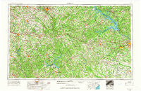
~ Athens GA topo map, 1:250000 scale, 1 X 2 Degree, Historical, 1953, updated 1966
Athens, Georgia, USGS topographic map dated 1953.
Includes geographic coordinates (latitude and longitude). This topographic map is suitable for hiking, camping, and exploring, or framing it as a wall map.
Printed on-demand using high resolution imagery, on heavy weight and acid free paper, or alternatively on a variety of synthetic materials.
Topos available on paper, Waterproof, Poly, or Tyvek. Usually shipping rolled, unless combined with other folded maps in one order.
- Product Number: USGS-5365332
- Free digital map download (high-resolution, GeoPDF): Athens, Georgia (file size: 21 MB)
- Map Size: please refer to the dimensions of the GeoPDF map above
- Weight (paper map): ca. 55 grams
- Map Type: POD USGS Topographic Map
- Map Series: HTMC
- Map Verison: Historical
- Cell ID: 68652
- Scan ID: 247818
- Imprint Year: 1966
- Woodland Tint: Yes
- Aerial Photo Year: 1956
- Edit Year: 1965
- Field Check Year: 1953
- Datum: Unstated
- Map Projection: Transverse Mercator
- Map published by United States Geological Survey
- Map published by United States Army Corps of Engineers
- Map published by United States Army
- Map Language: English
- Scanner Resolution: 600 dpi
- Map Cell Name: Athens
- Grid size: 1 X 2 Degree
- Date on map: 1953
- Map Scale: 1:250000
- Geographical region: Georgia, United States
Neighboring Maps:
All neighboring USGS topo maps are available for sale online at a variety of scales.
Spatial coverage:
Topo map Athens, Georgia, covers the geographical area associated the following places:
- Rock and Shoals - Bradley - Fairplay - Smyrna - Salem - Tanglewood - Dyes Crossroad - Maddox - Country Wood - Sagamore Hills - Greenwood Acres - Montclair - Leah - Kaolin - Moss Side - Village Gate - Skyline Park - National Hills - Columbia Heights - Farrar - Berkley Hills - Deerfield - Kirkland Acres - Glades Cross-Roads - Idlewood - Modoc Subdivision - Woodland Acres - Quail Run - Greshamville - Ravenwood Park - Pine Hills - Huntington Park - Ficklin - Casa Linda - Raes (historical) - Athon (historical) - Lawrenceville - North High Shoals - Murphy Hills - Brighton Heights - Lincolnton - Spring Lakes - Whitney - Antioch - Oakdale Woods - Hickory Hill - Saddleback Estates - Broadacres Homes - Grove Mount - Daniel Springs - Martinez - Southwick - Berckman Hills - Eastmeadow - Mechanicsville (historical) - Lexington Estates - Bayvale - Jushua Tree Villas - Russell - Belmont - Pine Top Hill - Warfield - Edgewood - Beverly Heights - Warrenton - Glen Forest Mobile Home Park - Country Acres Mobile Home Park - Forest Creek - Modoc - Pepperidge - Rosemont - Mayfair - Sandtown - Windsor Spring - Nicholasville - Metasville - Oakbrook - Highpoint Mobile Home Park - Richmond Hills - Briarwood - Fairview Commons - Unified Government of Athens-Clarke County (Balance) - Plum Branch - Country Club Estates - Walnut Grove - Troy - Riverside Hills - Union - Cambridge - Swanson - Ansley Mill - Meda - Apollo (historical) - Chadds Walk - Crossties - Whitehall - Arrow Head - Apalachee - Adventure (historical) - Plainview
- Map Area ID: AREA3433-84-82
- Northwest corner Lat/Long code: USGSNW34-84
- Northeast corner Lat/Long code: USGSNE34-82
- Southwest corner Lat/Long code: USGSSW33-84
- Southeast corner Lat/Long code: USGSSE33-82
- Northern map edge Latitude: 34
- Southern map edge Latitude: 33
- Western map edge Longitude: -84
- Eastern map edge Longitude: -82


