
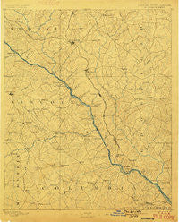
~ Mc Cormick SC topo map, 1:125000 scale, 30 X 30 Minute, Historical, 1892, updated 1899
Mc Cormick, South Carolina, USGS topographic map dated 1892.
Includes geographic coordinates (latitude and longitude). This topographic map is suitable for hiking, camping, and exploring, or framing it as a wall map.
Printed on-demand using high resolution imagery, on heavy weight and acid free paper, or alternatively on a variety of synthetic materials.
Topos available on paper, Waterproof, Poly, or Tyvek. Usually shipping rolled, unless combined with other folded maps in one order.
- Product Number: USGS-5365246
- Free digital map download (high-resolution, GeoPDF): Mc Cormick, South Carolina (file size: 8 MB)
- Map Size: please refer to the dimensions of the GeoPDF map above
- Weight (paper map): ca. 55 grams
- Map Type: POD USGS Topographic Map
- Map Series: HTMC
- Map Verison: Historical
- Cell ID: 66017
- Scan ID: 247756
- Imprint Year: 1899
- Survey Year: 1890
- Datum: Unstated
- Map Projection: Unstated
- Map published by United States Geological Survey
- Map Language: English
- Scanner Resolution: 600 dpi
- Map Cell Name: McCormick
- Grid size: 30 X 30 Minute
- Date on map: 1892
- Map Scale: 1:125000
- Geographical region: South Carolina, United States
Neighboring Maps:
All neighboring USGS topo maps are available for sale online at a variety of scales.
Spatial coverage:
Topo map Mc Cormick, South Carolina, covers the geographical area associated the following places:
- Sedgefield - Appling - Martinez - Windsor Court - Lulaville - Bethany (historical) - Kennelworth - Eubank (historical) - Village at Watervale - Sheppard Crossroads - Pinewood - Parks Mill - New Richmond (historical) - Windmill Plantation - Loce - Highview Acres - Phillips Estates - Jamaica Estates - Holiday Park - Montclair - Creek View - Stevens Creek West - Meadowview - Lamkin - West Lynne - Woodbridge - West Hampton - Maxim - Westlake - Glennwood - Plum Branch - Limestone - Beverly Heights - Buffalo - Leathersville - Bordeaux - Deerwood Estates - Ropers Crossroads - West Hills - Edgewood - Camelot - Casa Linda - Winterseat - Evanston - Cambridge - Fernbrook - Modoc - Brunson Crossroads - Colliers - Bonair - Casa Bella - Shady Grove Estates - Phinizy - Spring Lakes - Bonaire Heights - Chimney Hill - Rousseau Spring (historical) - Huntington - Winfield - Whitetown - Hamilton Crossroads - Dunn Chapel - Millers Crossroads - Howell - Rosemont - Gaines Court - Dorchester - Leverett - Woodland - Whispering Pine Mobile Home Park - Candlewood Crossing - Pollards Corner - Stones Crossroads - Liberty Hill - Agnes (historical) - Lethia - Evans Mill - Meriwether - Delph (historical) - Westport - Sterling Heights - Shenandoah Woods - Snead - McCormick - Clay Hill - Modoc Subdivision - Troy - Whites Cross Roads (historical) - Stallings Place - Forest Park - Farmington - Winfield Hill - West Store Crossroads - Forest Creek - Bristol Wood - Cedar Hill - Salem (historical) - Woodlawn - Pittsburg - Lincolnton
- Map Area ID: AREA3433.5-82.5-82
- Northwest corner Lat/Long code: USGSNW34-82.5
- Northeast corner Lat/Long code: USGSNE34-82
- Southwest corner Lat/Long code: USGSSW33.5-82.5
- Southeast corner Lat/Long code: USGSSE33.5-82
- Northern map edge Latitude: 34
- Southern map edge Latitude: 33.5
- Western map edge Longitude: -82.5
- Eastern map edge Longitude: -82


