
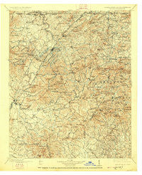
~ Ellijay GA topo map, 1:125000 scale, 30 X 30 Minute, Historical, 1911, updated 1926
Ellijay, Georgia, USGS topographic map dated 1911.
Includes geographic coordinates (latitude and longitude). This topographic map is suitable for hiking, camping, and exploring, or framing it as a wall map.
Printed on-demand using high resolution imagery, on heavy weight and acid free paper, or alternatively on a variety of synthetic materials.
Topos available on paper, Waterproof, Poly, or Tyvek. Usually shipping rolled, unless combined with other folded maps in one order.
- Product Number: USGS-5365226
- Free digital map download (high-resolution, GeoPDF): Ellijay, Georgia (file size: 11 MB)
- Map Size: please refer to the dimensions of the GeoPDF map above
- Weight (paper map): ca. 55 grams
- Map Type: POD USGS Topographic Map
- Map Series: HTMC
- Map Verison: Historical
- Cell ID: 65430
- Scan ID: 247741
- Imprint Year: 1926
- Survey Year: 1896
- Datum: NAD
- Map Projection: Polyconic
- Map published by United States Geological Survey
- Map Language: English
- Scanner Resolution: 600 dpi
- Map Cell Name: Ellijay
- Grid size: 30 X 30 Minute
- Date on map: 1911
- Map Scale: 1:125000
- Geographical region: Georgia, United States
Neighboring Maps:
All neighboring USGS topo maps are available for sale online at a variety of scales.
Spatial coverage:
Topo map Ellijay, Georgia, covers the geographical area associated the following places:
- Wilscot - Pleasant Grove - Curtis - Quill - Chopped Oak - Ballew Mill - Newport - Maxwell - Bryan Mill - Oakland - Dyke - Burnett - Youngcane (historical) - Craytonia - Santaluca - Kingtown - White Path - Sugar Creek - Pisgah - Padena - Tickanetley - Jay (historical) - Emma - Suches - Loving - Windy Ridge - Jones Creek - Lucius - Turniptown (historical) - Dial - Swan - Chestnut Gap - Wright Mill - Johntown (historical) - Higdon - Stock Hill - Pike (historical) - Jonestown - Oasis - Baxter - Hemp - Notalee Orchards - Bethlehem - Blue Ridge - Rolston - Morganton - Snider (historical) - Aska - Kyle - Pierceville - Newtown - Goose Island - Stewart Mill - Cherry Log - Staffordtown - Hedwig (historical) - Oak Hill - Roy - Sarah - Due (historical) - Forge Mill - Madola - Dunn - Epworth - Cartecay - Ai - Cooper Creek - Colwell - Stanley Mill (historical) - Coles Crossing - McCaysville - Cane Creek - Rogers (historical) - Murphy Junction - Mashburn Mill - Williamstown - Yukon - Mineral Bluff - Cutcane - Jones Mill (historical) - Lewner - Brown Mill - Pleasant Hill - Galloway Mill - Hurst - Three Forks - Bellview - Big Creek - Patterson Mill - Ellijay - Rocky Gap (historical) - Sweet Gum - Fry - Licklog (historical) - Salem - Maple Grove - Lickskillet - Bunker Hill - Argo (historical) - Wier (historical)
- Map Area ID: AREA3534.5-84.5-84
- Northwest corner Lat/Long code: USGSNW35-84.5
- Northeast corner Lat/Long code: USGSNE35-84
- Southwest corner Lat/Long code: USGSSW34.5-84.5
- Southeast corner Lat/Long code: USGSSE34.5-84
- Northern map edge Latitude: 35
- Southern map edge Latitude: 34.5
- Western map edge Longitude: -84.5
- Eastern map edge Longitude: -84


