
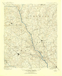
~ Elberton GA topo map, 1:125000 scale, 30 X 30 Minute, Historical, 1893, updated 1951
Elberton, Georgia, USGS topographic map dated 1893.
Includes geographic coordinates (latitude and longitude). This topographic map is suitable for hiking, camping, and exploring, or framing it as a wall map.
Printed on-demand using high resolution imagery, on heavy weight and acid free paper, or alternatively on a variety of synthetic materials.
Topos available on paper, Waterproof, Poly, or Tyvek. Usually shipping rolled, unless combined with other folded maps in one order.
- Product Number: USGS-5365214
- Free digital map download (high-resolution, GeoPDF): Elberton, Georgia (file size: 8 MB)
- Map Size: please refer to the dimensions of the GeoPDF map above
- Weight (paper map): ca. 55 grams
- Map Type: POD USGS Topographic Map
- Map Series: HTMC
- Map Verison: Historical
- Cell ID: 65414
- Scan ID: 247733
- Imprint Year: 1951
- Survey Year: 1890
- Datum: Unstated
- Map Projection: Polyconic
- Map published by United States Geological Survey
- Map Language: English
- Scanner Resolution: 600 dpi
- Map Cell Name: Elberton
- Grid size: 30 X 30 Minute
- Date on map: 1893
- Map Scale: 1:125000
- Geographical region: Georgia, United States
Neighboring Maps:
All neighboring USGS topo maps are available for sale online at a variety of scales.
Spatial coverage:
Topo map Elberton, Georgia, covers the geographical area associated the following places:
- Nevitt Woods - Clarks Junction - Nuberg - Starr - Homeland Park - Rocky River (historical) - Goss - Heardmont - Meadow Park - Monteideo (historical) - Calhoun Falls - Stansell (historical) - Lake Secession - Beverly - Westview Heights - Latimer - Mount Olivet - Calhoun Hills - Concordia (historical) - Dresden (historical) - Chambert Forest - Vandale Place - Green Acres - Hartwell - Meadow Fields - Varennes Heights - Mountain Creek - Allendale - Nevitt Pines - Ruckersville - Broadview Estates - Clover Hill - Harmony - Brownlee Crossroads - Dewy Rose - Meadow Brook - Oglesby - Ethridge - Nevitt Forest - Gluck - Caldwell Village - Normandy Park - Lyonswood - Edinburg (historical) - Fortsonia - Fernwood - Christopher Heights - Rucker Court - Coldwater - Saylors Crossroads - Rock Branch - Iva - Antreville - Chesnut Hill (historical) - Elberton - Hester - Monterey (historical) - Sadler (historical) - Storeville (historical) - Mount Carmel - Montevideo - Toxaway - Beverly Hills - Duke (historical) - Hard Cash - Andersonville (historical) - Maretts - Thirteen Forks - Anderson Gardens - Indian Trail - Carolina Springs - Barnes Station - Dove Creek - Silk Mills - Varennes (historical) - Gladstone Acres - Fains Store - Pearl - Reed Creek - Diamond Hill Spring (historical) - Lowndesville - Centerville - Pine Forest - Cauthen - Lakefront - Flat Rock - Fairfield Acres - Deans - Greenbriar - Flat Shoals - Harper - Middleton - Price (historical) - Moffitsville - Holland Store - Amandaville (historical) - Cloverdale - Bio - Normandy Park Junior - Oak Bower (historical)
- Map Area ID: AREA34.534-83-82.5
- Northwest corner Lat/Long code: USGSNW34.5-83
- Northeast corner Lat/Long code: USGSNE34.5-82.5
- Southwest corner Lat/Long code: USGSSW34-83
- Southeast corner Lat/Long code: USGSSE34-82.5
- Northern map edge Latitude: 34.5
- Southern map edge Latitude: 34
- Western map edge Longitude: -83
- Eastern map edge Longitude: -82.5


