
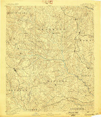
~ Carnesville GA topo map, 1:125000 scale, 30 X 30 Minute, Historical, 1891, updated 1898
Carnesville, Georgia, USGS topographic map dated 1891.
Includes geographic coordinates (latitude and longitude). This topographic map is suitable for hiking, camping, and exploring, or framing it as a wall map.
Printed on-demand using high resolution imagery, on heavy weight and acid free paper, or alternatively on a variety of synthetic materials.
Topos available on paper, Waterproof, Poly, or Tyvek. Usually shipping rolled, unless combined with other folded maps in one order.
- Product Number: USGS-5365158
- Free digital map download (high-resolution, GeoPDF): Carnesville, Georgia (file size: 8 MB)
- Map Size: please refer to the dimensions of the GeoPDF map above
- Weight (paper map): ca. 55 grams
- Map Type: POD USGS Topographic Map
- Map Series: HTMC
- Map Verison: Historical
- Cell ID: 65137
- Scan ID: 247687
- Imprint Year: 1898
- Survey Year: 1889
- Datum: Unstated
- Map Projection: Unstated
- Map published by United States Geological Survey
- Map Language: English
- Scanner Resolution: 600 dpi
- Map Cell Name: Carnesville
- Grid size: 30 X 30 Minute
- Date on map: 1891
- Map Scale: 1:125000
- Geographical region: Georgia, United States
Neighboring Maps:
All neighboring USGS topo maps are available for sale online at a variety of scales.
Spatial coverage:
Topo map Carnesville, Georgia, covers the geographical area associated the following places:
- Diamond Rock (historical) - Canon - Shiloh - Erastus - Barretts Mill - Diamond Hill - Ashland - Jeptha - Carnesville - Gholston Stand Crossroads - Shoal Creek - Attica - Goldmine - Brockton - Vandiver - Toms Creek - Neese - Velpoe - Pinefield Crossroads - Grove Level - Red Hill - Danielsville - Nicholson - Vanna - Salubrity (historical) - Patterson - Colbert - Smithonia - Seymours Store - Northridge - Ross - Harrison - Cherokee Forest - Ila - Newtown - Odis Crossroads - Minish - Five Points - Fairview - Fort Lamar - Seagraves - Alvin - Pruitt - Nickville - Whitworth - Reeds - Gumlog - Carlan - Hamilton Trailer Park - Bowersville - Royston - Walnut Hill (historical) - Unity - Arp - Hix - Phillips - Clarksboro - Carlton - Uvena - Sandy Cross - Prospect - Paoli - Smiths Store - Vineyard Creek - Hebron - Dalton - Mize - Parkertown Mill - Parhams - Commerce - Bluestone - Bowman - Lavonia - Planter - Match - Parkertown - Cedar Grove - Pocataligo - Transco - Zidon (historical) - Sanford - Martin - Porterfield - Comer - Cromers - Country Corner Mobile Home Park - James Spring (historical) - Center - Mount Pleasant - Franklin Springs - Nancytown (historical) - Banks Crossing - Homer - Jewelville - Eagle Grove - Bond - Trail Creek Estates Mobile Home Park - Dowdy (historical) - Hull - Rogers
- Map Area ID: AREA34.534-83.5-83
- Northwest corner Lat/Long code: USGSNW34.5-83.5
- Northeast corner Lat/Long code: USGSNE34.5-83
- Southwest corner Lat/Long code: USGSSW34-83.5
- Southeast corner Lat/Long code: USGSSE34-83
- Northern map edge Latitude: 34.5
- Southern map edge Latitude: 34
- Western map edge Longitude: -83.5
- Eastern map edge Longitude: -83


