
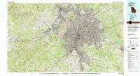
~ Atlanta GA topo map, 1:100000 scale, 30 X 60 Minute, Historical, 1981, updated 1982
Atlanta, Georgia, USGS topographic map dated 1981.
Includes geographic coordinates (latitude and longitude). This topographic map is suitable for hiking, camping, and exploring, or framing it as a wall map.
Printed on-demand using high resolution imagery, on heavy weight and acid free paper, or alternatively on a variety of synthetic materials.
Topos available on paper, Waterproof, Poly, or Tyvek. Usually shipping rolled, unless combined with other folded maps in one order.
- Product Number: USGS-5365074
- Free digital map download (high-resolution, GeoPDF): Atlanta, Georgia (file size: 42 MB)
- Map Size: please refer to the dimensions of the GeoPDF map above
- Weight (paper map): ca. 55 grams
- Map Type: POD USGS Topographic Map
- Map Series: HTMC
- Map Verison: Historical
- Cell ID: 67077
- Scan ID: 247622
- Imprint Year: 1982
- Woodland Tint: Yes
- Aerial Photo Year: 1975
- Edit Year: 1981
- Datum: NAD27
- Map Projection: Universal Transverse Mercator
- Map published by United States Geological Survey
- Map Language: English
- Scanner Resolution: 600 dpi
- Map Cell Name: Atlanta
- Grid size: 30 X 60 Minute
- Date on map: 1981
- Map Scale: 1:100000
- Geographical region: Georgia, United States
Neighboring Maps:
All neighboring USGS topo maps are available for sale online at a variety of scales.
Spatial coverage:
Topo map Atlanta, Georgia, covers the geographical area associated the following places:
- Clayton Ridge - Heatherwood - Green Valley Estates - Stanebrook - Brookhaven - Spalding Hills - Wood Valley - Clifton - Caleb - Lockridge Forest - Laurel Heights - Cherokee Hills - Sweet Briar Mobile Home Park - Emerald Hills - Windsor at Peachtree - Stoneybrook - Kenwood - Haven Park - Rolling Meadows - Castile Cove - Pinehurst - Buckhead - Hills Park - Home Place Acres - The Noles Estates - Blue Ridge Manor - Chapel Mill - Rolling View Estates - Bear Creek Estates - The Meadows North - Burnt Hickory Estates - Midway Estates - Woodhaven Estates - Timberlake - Hanlin - Gloster - Paces Lakes - East Lake - Northwoods - Fielder Manor - Club Drive - Blackwells - Deerfield - Tara Woods - The Oaks - Grove Park - Red Rock Hills - Banning Mills - Paris Manor - Hidden Lakes - Oakbrook Forest - Castlegate - Suffolk Downs - Riverside - Clarkdale - West Springs - Echo Ridge - West Forest - Turner Village - Paradise Park - Habersham - Hyde Park Mobile Home Park - Furniture City - Five Forks - Rosedale Heights - Hidden Hills - Mecca (historical) - Old South - Mill Glen - Heritage Valley - Oak Dale Manor - Pleasant Acres - Hyde Park - Barcelona Estates - Aspen Acres - Bristol Downs - Coronado Forest - Twin Village - Flowers Crossing - Bear Creek Estates - River Hills - Innsbrook - Greenfield Chase - Springwood Village - Quail Valley - Calumet West - Forest Park - Creelwood - Cumberland Hill - Bermuda - White Forest - Enon - Jamestown Court - Collinsville - Magnet - Richardson - Woods Valley - Centerville - Wallace (historical) - Palmetto
- Map Area ID: AREA3433.5-85-84
- Northwest corner Lat/Long code: USGSNW34-85
- Northeast corner Lat/Long code: USGSNE34-84
- Southwest corner Lat/Long code: USGSSW33.5-85
- Southeast corner Lat/Long code: USGSSE33.5-84
- Northern map edge Latitude: 34
- Southern map edge Latitude: 33.5
- Western map edge Longitude: -85
- Eastern map edge Longitude: -84


