
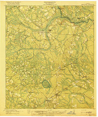
~ Hinesville GA topo map, 1:62500 scale, 15 X 15 Minute, Historical, 1918
Hinesville, Georgia, USGS topographic map dated 1918.
Includes geographic coordinates (latitude and longitude). This topographic map is suitable for hiking, camping, and exploring, or framing it as a wall map.
Printed on-demand using high resolution imagery, on heavy weight and acid free paper, or alternatively on a variety of synthetic materials.
Topos available on paper, Waterproof, Poly, or Tyvek. Usually shipping rolled, unless combined with other folded maps in one order.
- Product Number: USGS-5364860
- Free digital map download (high-resolution, GeoPDF): Hinesville, Georgia (file size: 8 MB)
- Map Size: please refer to the dimensions of the GeoPDF map above
- Weight (paper map): ca. 55 grams
- Map Type: POD USGS Topographic Map
- Map Series: HTMC
- Map Verison: Historical
- Cell ID: 320807
- Scan ID: 247478
- Woodland Tint: Yes
- Survey Year: 1917
- Datum: Unstated
- Map Projection: Unstated
- Map published by United States Army Corps of Engineers
- Map published by United States Department of War
- Map Language: English
- Scanner Resolution: 600 dpi
- Map Cell Name: Hinesville
- Grid size: 15 X 15 Minute
- Date on map: 1918
- Map Scale: 1:62500
- Geographical region: Georgia, United States
Neighboring Maps:
All neighboring USGS topo maps are available for sale online at a variety of scales.
Spatial coverage:
Topo map Hinesville, Georgia, covers the geographical area associated the following places:
- Martin Woods - Allenhurst - Pinewood Estates - Cherokee Village - Garden Heights - Pointe South - Herbert Heights - Bryan Village - Wildwood - Gum Branch - Salter Mobile Home Park - Fraser Acres - Fort Stewart - Roberts Mobile Home Park - Creek Island - Bradwell Estates - Harrison Heights - Country Lane Mobile Home Park - Pipkin Mobile Home Park - Hinesville - Victory Manor Mobile Home Court - Olmstead - Deer Run Estates - Sandy Run - Way Subdivision - Pineview - Doyles Mobile Home Park - Darlot - Doe Run Estates - Country Manor Mobile Home Park - Aimar - Mill Creek - Deerwood Estates - Taylors Creek (historical) - Tupelo Trail - Woodwind South - Alsennias Trailer Park - Walthourville - Bowen - Evergreen - Ashmore - Hallwood Homes - Maple Subdivision - Northwest Woods - Oakview Mobile Home Park - Flemington - Eagle Creek Mobile Home Community - Hidden Pines - Mosely Mobile Home Park - Trinity - Live Oak - Lancaster Estates - Martins (historical) - Cinder Hill - Garden Acres - McIntosh - Elim
- Map Area ID: AREA3231.75-81.75-81.5
- Northwest corner Lat/Long code: USGSNW32-81.75
- Northeast corner Lat/Long code: USGSNE32-81.5
- Southwest corner Lat/Long code: USGSSW31.75-81.75
- Southeast corner Lat/Long code: USGSSE31.75-81.5
- Northern map edge Latitude: 32
- Southern map edge Latitude: 31.75
- Western map edge Longitude: -81.75
- Eastern map edge Longitude: -81.5


