
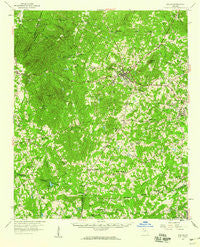
~ Dallas GA topo map, 1:62500 scale, 15 X 15 Minute, Historical, 1958, updated 1960
Dallas, Georgia, USGS topographic map dated 1958.
Includes geographic coordinates (latitude and longitude). This topographic map is suitable for hiking, camping, and exploring, or framing it as a wall map.
Printed on-demand using high resolution imagery, on heavy weight and acid free paper, or alternatively on a variety of synthetic materials.
Topos available on paper, Waterproof, Poly, or Tyvek. Usually shipping rolled, unless combined with other folded maps in one order.
- Product Number: USGS-5364762
- Free digital map download (high-resolution, GeoPDF): Dallas, Georgia (file size: 11 MB)
- Map Size: please refer to the dimensions of the GeoPDF map above
- Weight (paper map): ca. 55 grams
- Map Type: POD USGS Topographic Map
- Map Series: HTMC
- Map Verison: Historical
- Cell ID: 53184
- Scan ID: 247413
- Imprint Year: 1960
- Woodland Tint: Yes
- Aerial Photo Year: 1955
- Field Check Year: 1958
- Datum: NAD27
- Map Projection: Polyconic
- Map published by United States Geological Survey
- Map Language: English
- Scanner Resolution: 600 dpi
- Map Cell Name: Dallas
- Grid size: 15 X 15 Minute
- Date on map: 1958
- Map Scale: 1:62500
- Geographical region: Georgia, United States
Neighboring Maps:
All neighboring USGS topo maps are available for sale online at a variety of scales.
Spatial coverage:
Topo map Dallas, Georgia, covers the geographical area associated the following places:
- Yorkville - Indian Lake - Country Acres - Mulberry Place - Braswell - Ashley Acres - Coppermine Estates - Brownsville - Emerald Forest - Paces Lakes - Lost Meadows - Mountain Trace - Heritage Estates - Spanish Trails - Hiram - Wood Valley - Mount Tabor Trace - Lake Swan - Country Square - Union - Denton Estates - Colonial Hills - Rollins - Ash - Scoggins Ridge - Beverly Estates - Tabor Estates - Plantation Estates - Fleetwood Hills - Hartfield Estates - Westward Ho - Cobb Estates - Denton Farms - Oak Haven - Campground School Estates - Quail Run - New Georgia Estates - Wildwood - Saddle Up Estates - Pilgrim North - Spring Ridge Estates - Carrington Chase - Hasford Estates - Echo Ridge - Hickory Gap - Meadow Lark - Greenfield Summit - Mill Creek Place - Hanlin - Sweetwater Estates - Bud - Westwood Heights - Brookwood - White Forest - Bromley Estates - Oak Creek - Forrister - Sunset Hills - Quail Run East - Sunny Acres - Deer Run - Lincoln Heights - Burnt Hickory Acres - Wilbanks Circle - Rolling View Estates - Oak Dale Manor - Winndale - Nebo Gardens - Brooks Estates - Rock Falls Estates - Mountainview Estates - Brock - Hart Circle - Hartfield Acres - Devonshire - Asbury Woods - Forest Echo - Nebo - Hidden Oaks - Gordon Estates - Ridge Corners - Divide - Country Club Estates - Piney Woods Manor - Ridgeview Heights - Baldwin Hills - Meadowbrook - Greenacres - Acorn Tree - The Highlands - Green Meadows - Macland Springs - Sprayberry Farms - New Georgia - Pine Forest - Oberlochen - Hopecastle Forest - Twelve Oaks - Bakers Bridge Estates - Indian Springs
- Map Area ID: AREA3433.75-85-84.75
- Northwest corner Lat/Long code: USGSNW34-85
- Northeast corner Lat/Long code: USGSNE34-84.75
- Southwest corner Lat/Long code: USGSSW33.75-85
- Southeast corner Lat/Long code: USGSSE33.75-84.75
- Northern map edge Latitude: 34
- Southern map edge Latitude: 33.75
- Western map edge Longitude: -85
- Eastern map edge Longitude: -84.75


